A perfect weekend get-away from the city is the Björkö-Panike Trail in the UNESCO World Heritage Site of the Kvarken Archipelago. All you need is your packraft, a bivy and some water, and you’re in for a wild trip where you won’t encounter anyone else!

Disclosure: In this article there are several Affiliate links to disclose 😊 You can use these AT NO EXTRA COST TO YOU but I get a small provision from the company. As you know: I’m keepin’ it real and tell you how it is - I maintain full editorial control of the content published on Hiking in Finland. Read the Transparency Disclaimer for more information on blogger transparency and affiliate links.
It’s Friday, I had a mediocre week, the weather forecast is amazing and we wanna go to the beach. I do feel like sleeping outside, though. “Should we go to the Björköby beach?” I ask my wife, “Then I could go backpacking and you pick me up tomorrow in Panike?”. “Yes, that’s fine.” Well, that went a lot easier than I expected. I pack my HUCKEPACKS Phoenix Lite pack with a few items, strap the Anfibio Rebel 2K packraft on top and slide the Wave paddle into the side pockets, and then we head out to the Archipelago.

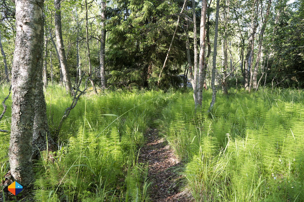
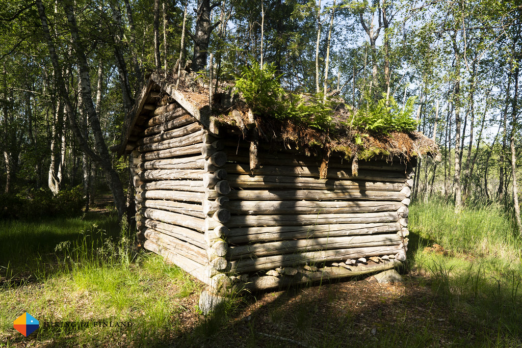
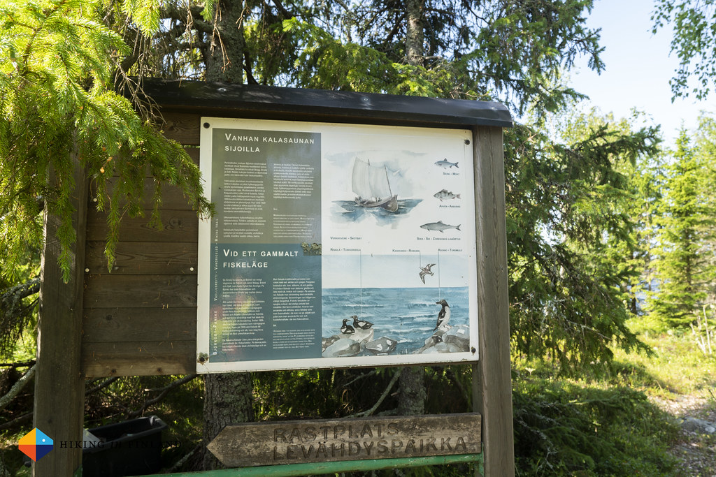
We’re pretty much alone at the beach, it’s 23°C and a light breeze goes - perfect weather. The kids love it, there’s fish everywhere and they try to catch them - even successfully at times. Fish are released, water melon is eaten, and then it’s time for me to start hiking at 19:00 o’clock. I say good bye to my family and start walking on the familiar Bodvattnet Runt trail towards the Långgrund fire place. The first kilometres are familiar, then I take a right and soon am swarmed by Mosquitos from the left, right, front and back. They don’t seem to be bothered by the repellant I sprayed on earlier, so all I can do is to hike faster. After 45 Minutes I arrive at the Fire shelter, which looks lovely.
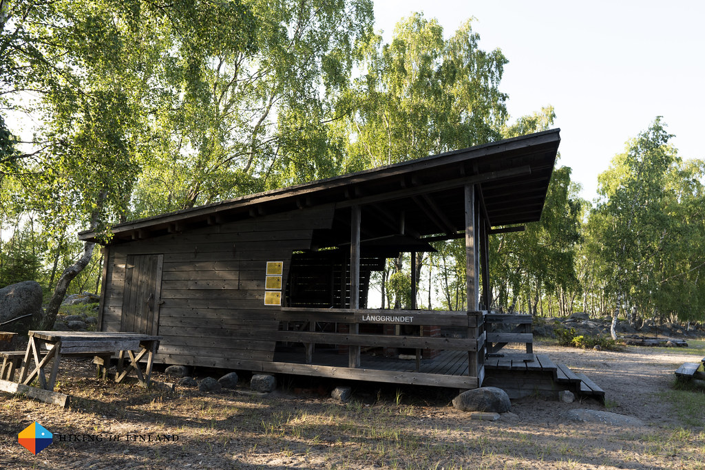


I drop my pack on a bench, take off my sweaty shirt, and walk out on the jetty. A Barn Swallow circles me, flying low above the water. I see a pair of Whopper Swans feed between the small islets, and in the distance the birdwatching Tower and buildings of Svedjehamn can be seen. I check my map, and start looking for the trail to the other jetty, from where I will be heading into sea.
I reach a land tongue 10 minutes later after hiking on a largely overgrown trail. This next section only can be reached if you organize boat transfer in advance - or if you have your own packraft along. I roll out the Rebel 2K, inflate it and put it down in the water so that the air in the tubes can cool down, so I can top it up before heading out. The wind is coming against me, but it’s only around 5 m/s so not too bad. After everything is packed aboard I sit down, close the spray deck and start to paddle. The sun shines on my right, it’s warm and I enjoy the sound of the water sloshing against the raft. It’s a very natural sound, and so relaxing.
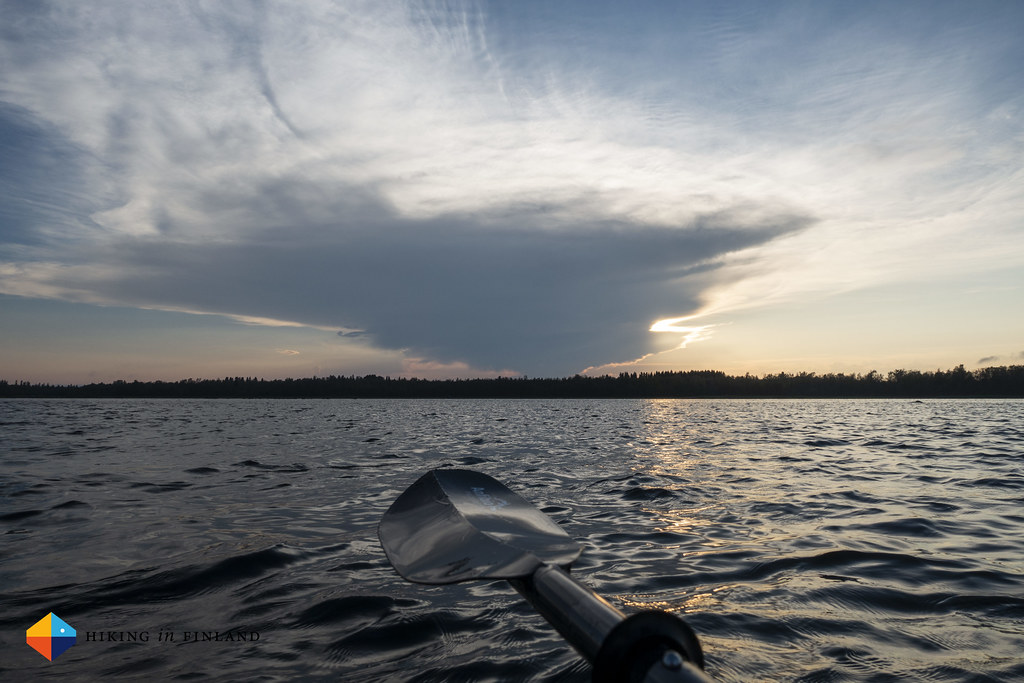
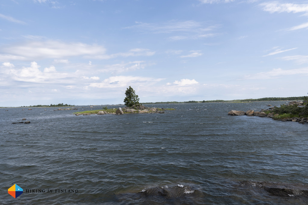
I paddle south-west in the middle of the Baltic, left and right of me the rising lands and islands. There are sections where the water is not even 30 cm deep, and I am happy that with my packraft I’m sitting pretty high in the water. Arctic Terns fly above me and check out what I’m up to, more Whopper Swans are looking for food along the shores, Great Crested Grebes dive away when they see me coming, only to surface 20 m further away. And then there’s lots, and lots of gulls: Black-Headed Gulls, Common Gulls, Herring Gulls and Great Black-backed Gulls all fly, sit and swim around me. As the wind is pushing me back to where I come from I only can keep on paddling, and when I arrive behind an island I can take in the view. It’s beautiful.
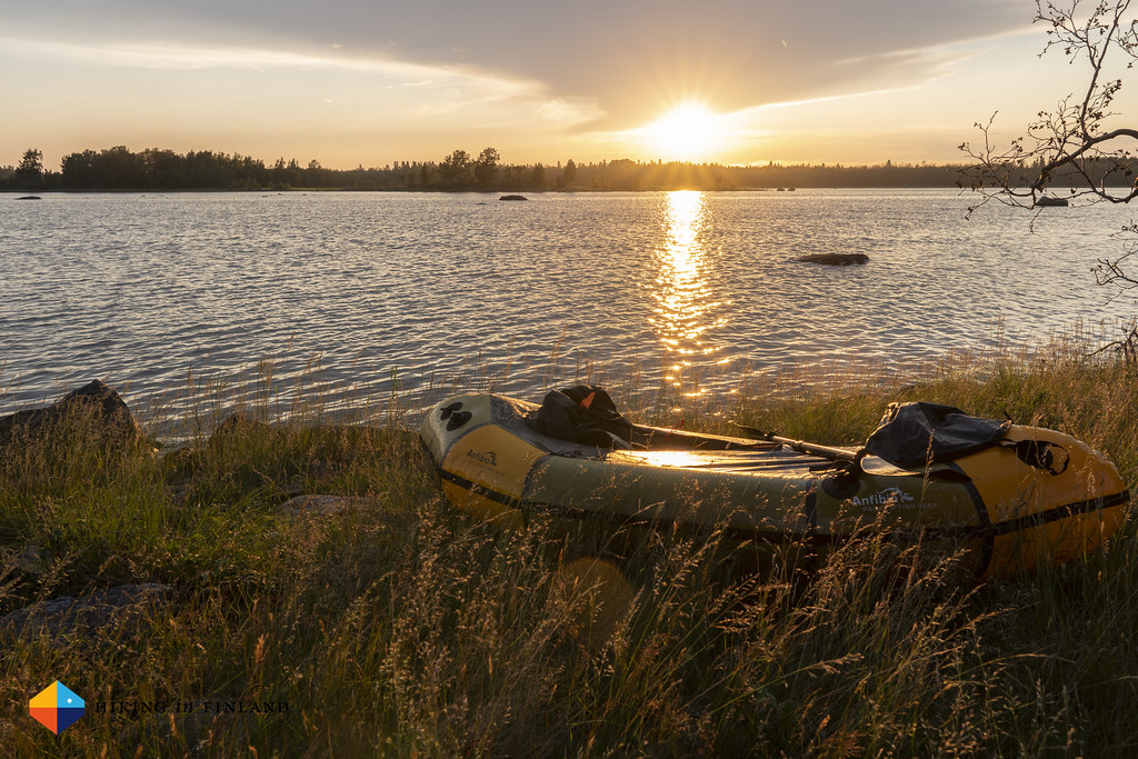
At 22:35 o’clock I land on the Sondasören island. According to my map there should be a place for camping here somewhere, but after a short stroll across the island and not finding it I decide to simply cowboy camp some 60 m up from the shore. I carry the packraft up, put it up as a sort of windbreak/ hoping it gives me some shadow in the early morning. I’m hungry after paddling some 3,5 km and hiking a similar distance, and after I rolled out my bivy I take out the MSR Windburner and boil some of the water which I brought along. Because this being the Baltic, it’s salt water, and hence I carried 3,5 kg of water with me from the start, by far the heaviest item in my pack!
I prepare my Nettle Curry from LYO Food, have a cup of mint tea, and enjoy the view. The sun is still up, a beautiful dusk is falling over the islands, and I hear sheep baa across the island, as well as some bells ring. Later the next day I will find out that on my island and the one I’ll be traversing the next day around 200 sheep are grazing the whole summer, and I also will see them the next morning.


Close to midnight I slide into the As Tucas Millaris Bivy, put my head down on the still fantastic NeoAir Uberlight and pull the ZPacks 10° quilt a bit over me. It’s a warm night, and soon the Mosquitos start to appear above my mesh window. They can’t get to me, but I decide to grab some of the death twigs and create a small tripod from where I can hang the bivy so the mesh net isn’t close to my face. While out collecting the twigs I also admire the almost orange moon which is setting in the west. It is beautiful.

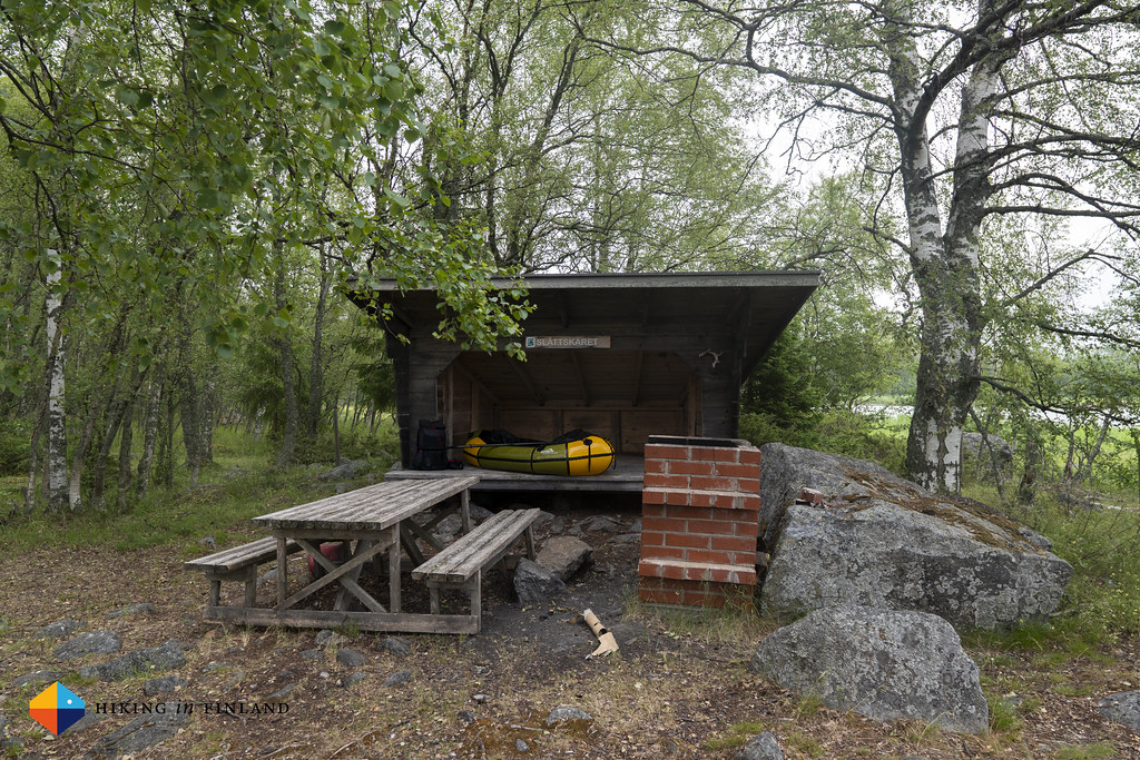
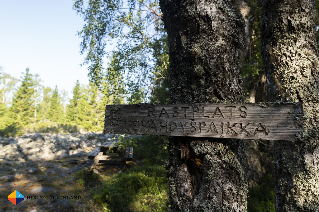
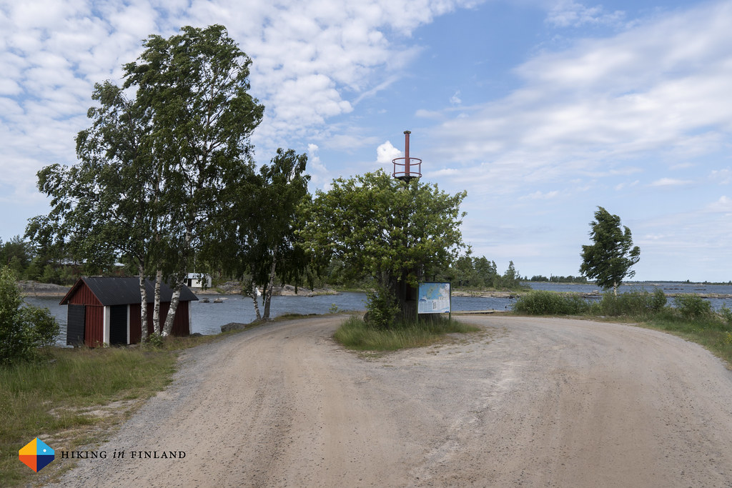
At 6:30 I’m awoken as a flock of sheep is having a look at me in my bivy, and as they see me sitting up they take flight. I switch the airplane mode of the phone off and check the weather forecast, as right now the sky is grey and high winds come from the North. Yep, even higher winds are forecasted, so instead of sleeping in I pack everything up and am before 7:00 o’clock back in my packraft. The wind is so strong that it picks up water from the sea, which has the effect of rain coming from the side. It looks worse than it actually is - I guess some things stuck from my Wilderness Guide Education 10 years ago - and 15 Minutes later I paddle up to the jetty at Slåttskäret. I carry everything up to the Laavu and have breakfast.
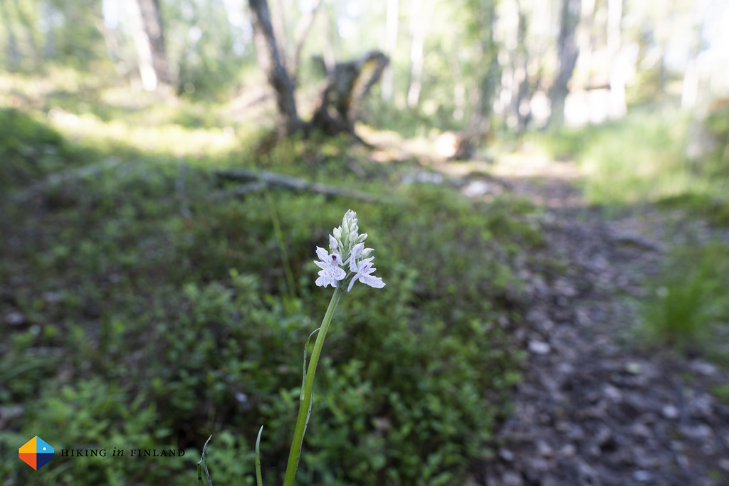
The sun comes out, though the wind keeps up, and a while later I start my hike on the island. The trail here is at times easy to follow and see, and at other times it’s pretty over grown. It passes geological sites - witnesses of our last ice age - and more recent additions, like shelters for the sheep which are grazing on the island. Along the way I see several Heath Spotted Orchids and a young White-tailed deer stag jumps across the trail and into the forest after it saw and heard me. It’s a beautiful, warm and windy morning, the Mosquitos aren’t out in force yet, and I enjoy the short hike to the end of the island.
I arrive after 1,5 hours at the end of the trail, and again walk down to the jetty. By now there’s 10 m/s winds and the waves have white crowns. Happily the Wind comes from North East, which is from my side, and it will push me toward the land where I have to go. I inflate the Rebel 2K for the final time, pack my backpack inside and sit down in the raft. I pull the hood of my Alpine Start Hoody over my cap, and push away from the jetty. The first few strokes are easy and no problem, but once I am in the wind it means “All Hands on Deck” as I need to keep the raft in the direction and keep on paddling, to not get pushed somewhere I don’t want to go, or worse. Towards the shore there’s some big waves and it’s a bumpy ride, but then again everything really is under control as I keep a calm head and know what I have to do (The first thing I should have done would have been to have a pfd along!).
20 Minutes later I arrive in the harbour of Panike, pull the packraft out of the water and walk up to a picknick table. This is the end of the road, and it’s just as silent. There’s a few summer cottages, a handful of boats are tied at the pier, and a hare is sitting in the grass at the side of the road, wondering maybe what that big heap of plastic is which is laying there in the sun. I dry the raft, roll it up, and wait for my ride back to Vaasa, while the wind is bending the top of the trees around me. What a beautiful hike this was, with beautiful views and weather. If you ever visit Finland and already have hiked the 9 Best Hikes of Finland and look for something new, consider this combined packrafting and hiking trip. I think it is great to try packrafting in a save environment, and it’s pretty lonely - great for a weekend hike!
If you enjoyed this article Please support me on Patreon as this COVID-19 Pandemic means a severe loss of income for me (and you get Discount codes for kit from partners!) or buy me a coffee - I work Full-Time on Hiking in Finland to bring you inspiring trip reports, in-depth gear reviews and the latest news from the outdoors. You also could subscribe to the rarer-than-ever Newsletter and follow along on Instagram, Twitter, Facebook and Youtube for more outdoorsy updates!
