Small countries attract Martin and me. Often overseen because of their large neighbours, small countries fly under the radar. Which we love, as that way you get to hike often in relative peace on magnificent trails, with views which put larger trails to shame. The Route 66 and Liechtenstein-Weg are two such trails which don’t need to hide - superb infrastructure, inspiring views, friendly locals and the possibility of hiking through a complete country make Liechtenstein a world-class hiking destination!
Disclosure: This trip was supported financially by the local tourism office. As you know: I’m keepin’ it real and tell you how it is - I maintain full editorial control of the content published on Hiking in Finland. Also, there are Affiliate links in this article which are marked with an ∞ Infinity Sign 😊 Read the Transparency Disclaimer for more information on affiliate links & blogger transparency.
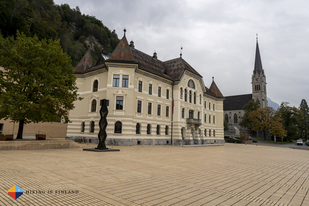
We meet in Switzerland at a railway station. It’s been again a year since we met, and much has happened since our hike in autumn 2020. We board a bus to Vaduz, the capital of Liechtenstein, where we arrive twenty-five minutes later. The capital of Liechtenstein is small - you can stroll through it easily. Above the town sits the castle of the Prince of Liechtenstein. It’s not a hiking day yet for us, so we drop our gear in our Hotel and go for lunch. On the way we are reminded that he-who-shall-not-be-named is still on the lose:

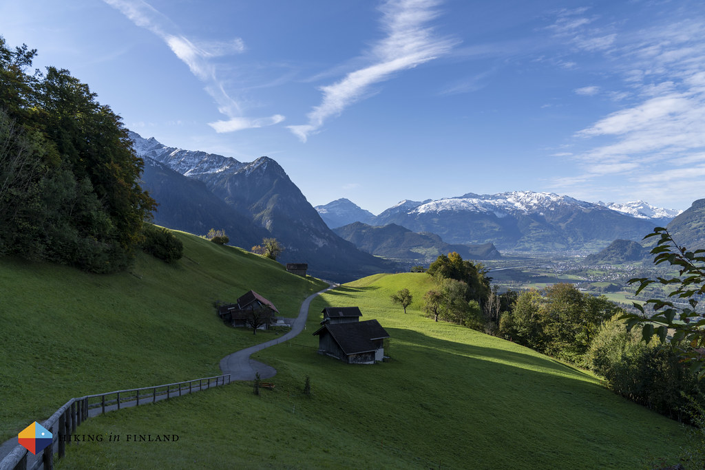
After a tasty lunch we decide to go and explore Vaduz. The trail which we want to hike the next few days, the Route 66, goes high above Vaduz through the mountains, but down here the Liechtenstein-Weg as well as a few more trails go through town. We decide to follow the trail up to the castle of the Prince, which gives some nice views over the town and over to Switzerland, which lays just behind the Upper Rhine, which is one of the natural borders of Liechtenstein.


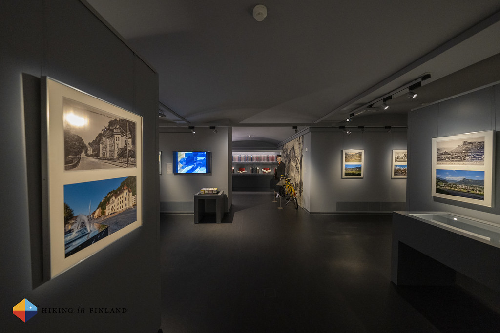
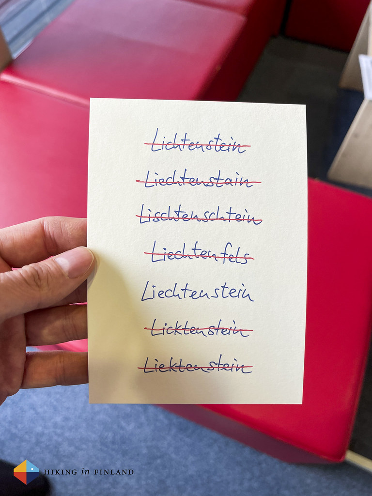
After our stroll up to the castle we took the same way back to town, where we explored a couple of the Museums and made sure to spell Liechtenstein correctly.
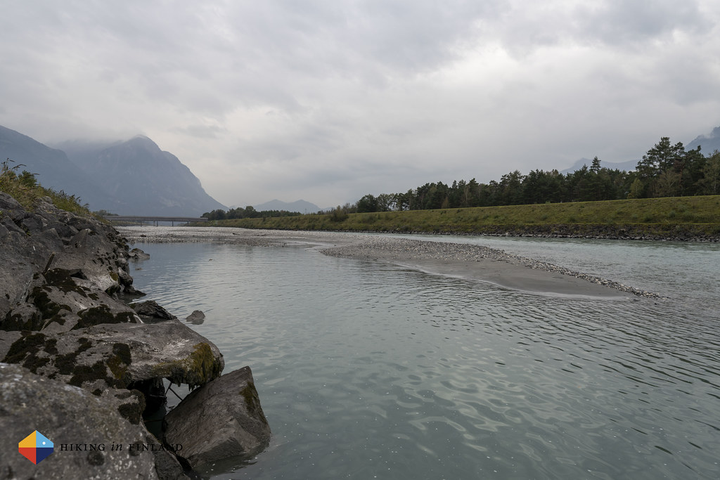
We decided we should walk to the Upper Rhine, as it’s just a short stroll through Vaduz, and we’d see more of the town, too.

After this wee excursion it was time to head back to the centre, enjoy the sauna at the hotel and then head for dinner, before getting ready for our first day of hiking.
Day 1 - From Nendeln to Ruggell
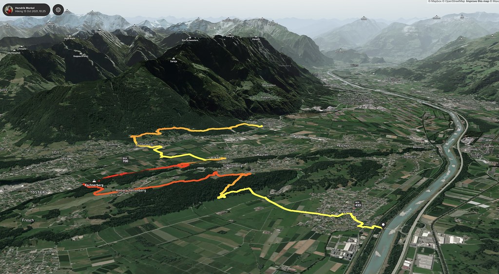
Usually we hike from Point A to B to C to D on our hikes. A clear starting point, a clear ending point. Sometimes we hike a loop, too - it’s easier from a transportation point-of-view. This time however, due to the weather, we needed to start our hike at Point C. This was still the moment we were planning to hike Route 66, the high alpine route, and as there was plenty of snow up in the mountains, as well as rain and snow in the forecast, we decided to hike first the last, low land section of the trail from Nendeln to Ruggell at the Swiss Border. For me this is fine, I like change and the possibility to do things differently - but for Martin it feels wrong.
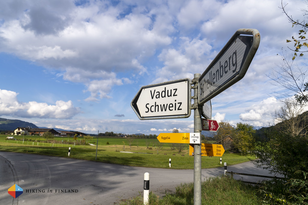
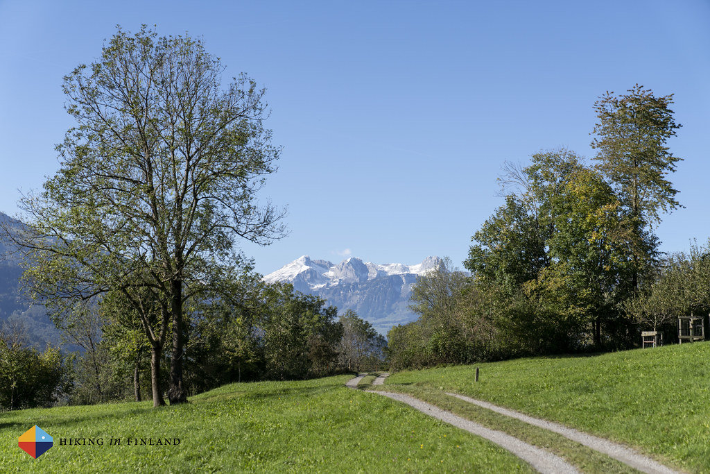
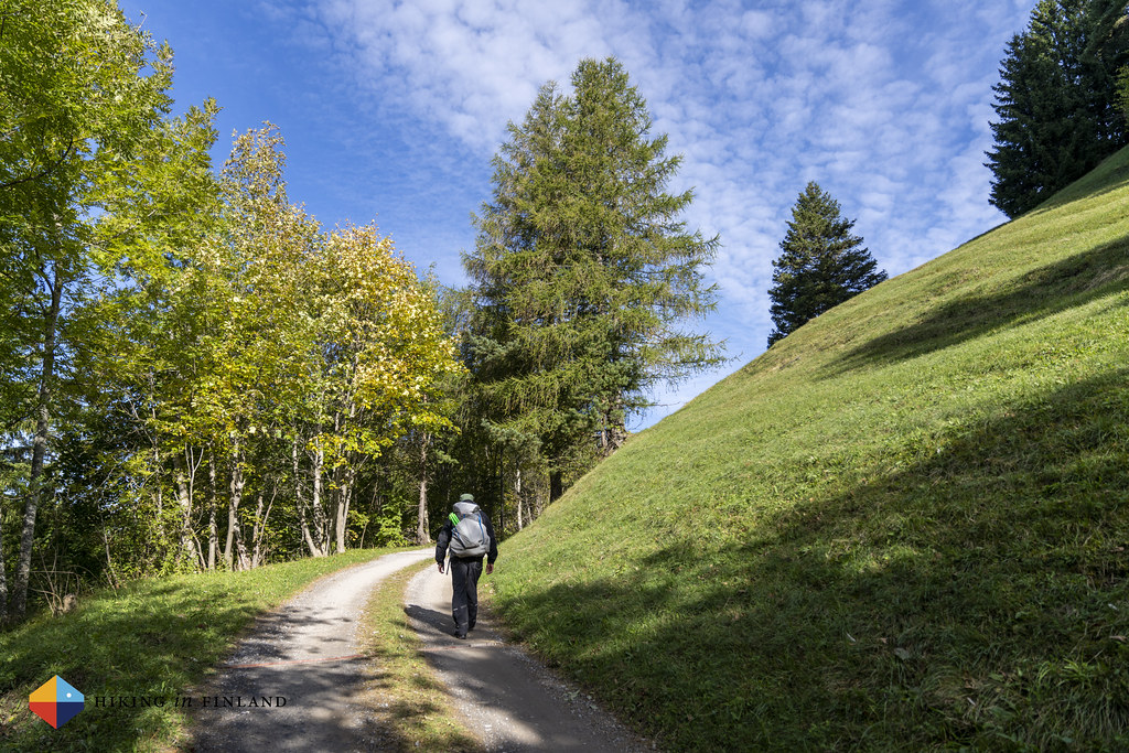
I totally get it. Doing something like a hike in a linear way, meaning starting at Point A and ending at Point D, makes a lot of sense. It minimizes transportation, and most importantly, it gives the feeling of hiking a trail from start to finish. But then jo-jo-ing, or section hiking, is quite common, especially on very long trails, and also makes a lot of sense if you want to do a hike in a given time frame and not return when the weather is better. So this time around we jo-jo this trail, because of the weather and conditions on the ground. Thanks to the good public transportation infrastructure in this small country we will be using the Bus to get around. Taking the Bus in Liechtenstein is easy, they’re just as punctual as in Switzerland, and so a short ride later we were in Nendeln, ready to start our hike. Above us the mountains are wearing a white blanket of snow, while down here it is a wee drizzle which means we are wearing our rain clothes.

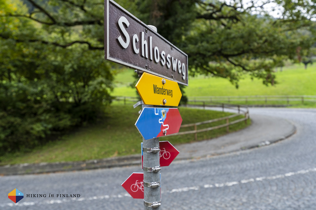
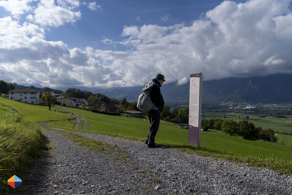
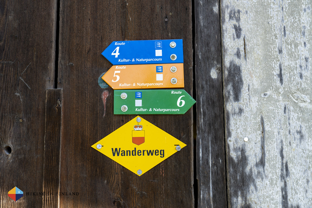
From the bus stop we hike up to the forest and the start of the trail. Navigation is easy as the Route 66, also known as the Liechtensteiner Panoramaweg, is well marked and getting lost is not easy. This makes it great for both beginner hikers who want an easy trail and more experienced hikers who don’t want to check the map all the time to make sure they’re still going in the right direction. It does not take us long and we’re on a nature trail, which takes the same route, and informs about the nature around one.
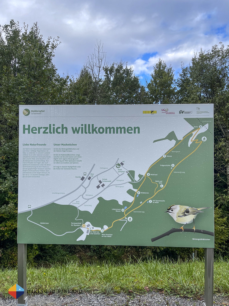

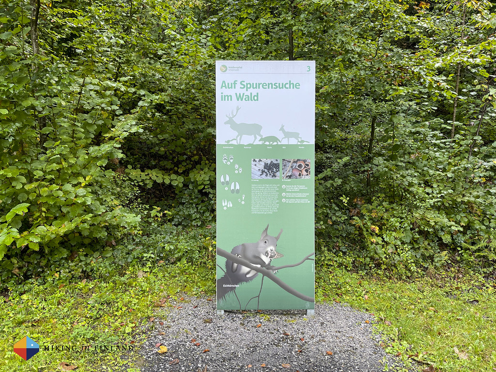

We make good speed on the trail, even though we stop at each sign to read about the nature around us. There’s a cool picture game on one, too, where you can guess the name of animals and insects on the front and see the correct answers on the back. It’s an easy and enjoyable walk over forest roads and trails, and soon we arrive in Schaanwald, the border town with Austria.


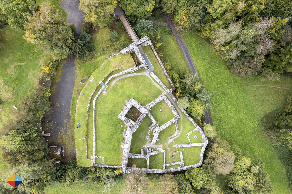
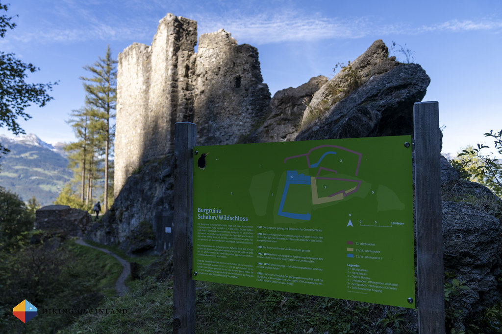
Also here in civilization the trail is well marked, and we follow it over a bridge to the Egelsee lake and onwards through a small village. Here you can drive easily into Austria if you don’t pay good attention to the roads 😃 We stay in Liechtenstein, and continue towards the Burgruine Schellenberg.


At this beautiful ruin we make a proper coffee break. Martin breaks out the ∞ Primus Lite+, cookies and coffee, while I fly my drone to take some sweet photos of this ruin. It’s a really cool location, and we talk about our common medieval reenactment past!
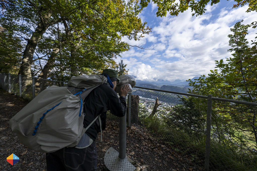
All good breaks have to end, and so we continue towards the North and Austria. Here we follow a trail which gives great views back to Liechtenstein’s mountains and into Austria - we are hiking on a cliff and at the bottom of the cliff is Austria, while up here we are in Liechtenstein. The trail has two different sets of info boards and installations along it, one for kids and one with historic information. Both sets of info boards are very informative and fun, and I can imagine that my kids would really enjoy this section of the trail.


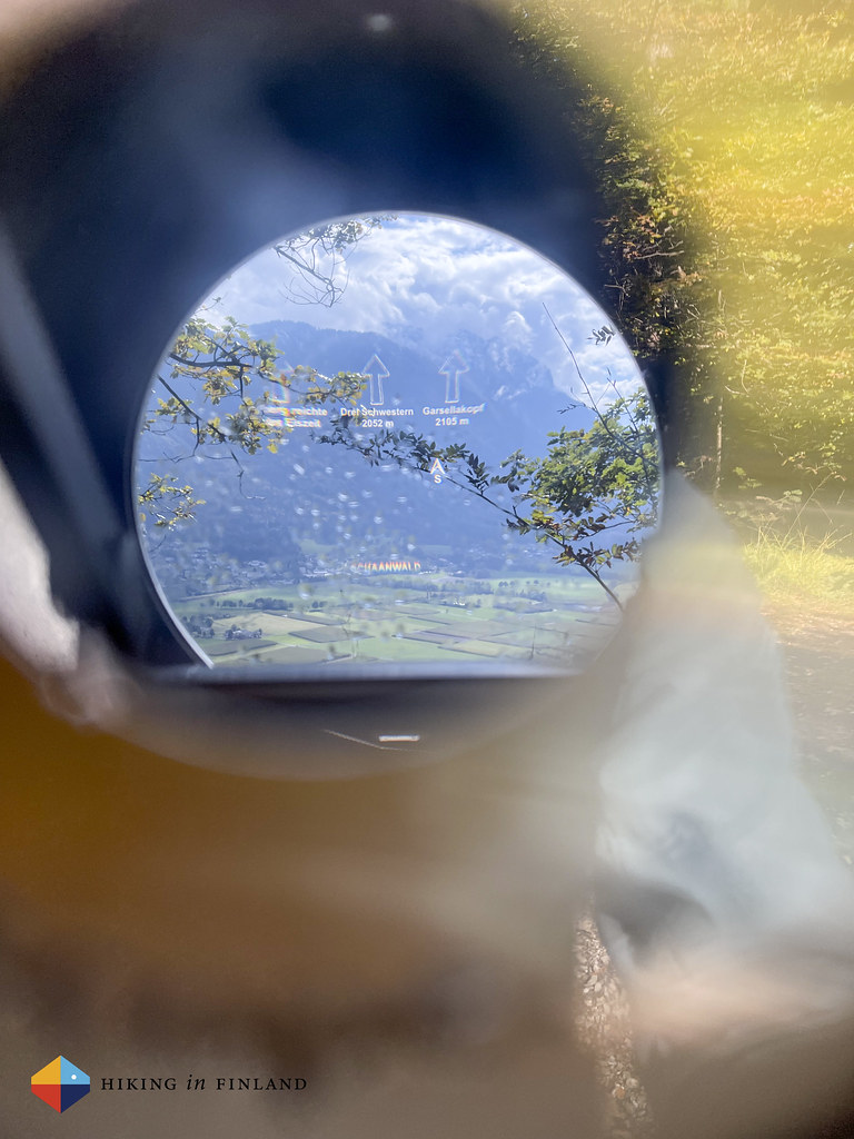
Very cool are the few telescopes along the trail. These have an optical overlay in them which changes when you move them around. So you’re able to identify the summits and places in the distance! It’s really informative and the first time we have seen something like it! The views themselves aren’t bad either, and helped by an improving weather - there is blue sky and sunshine now!
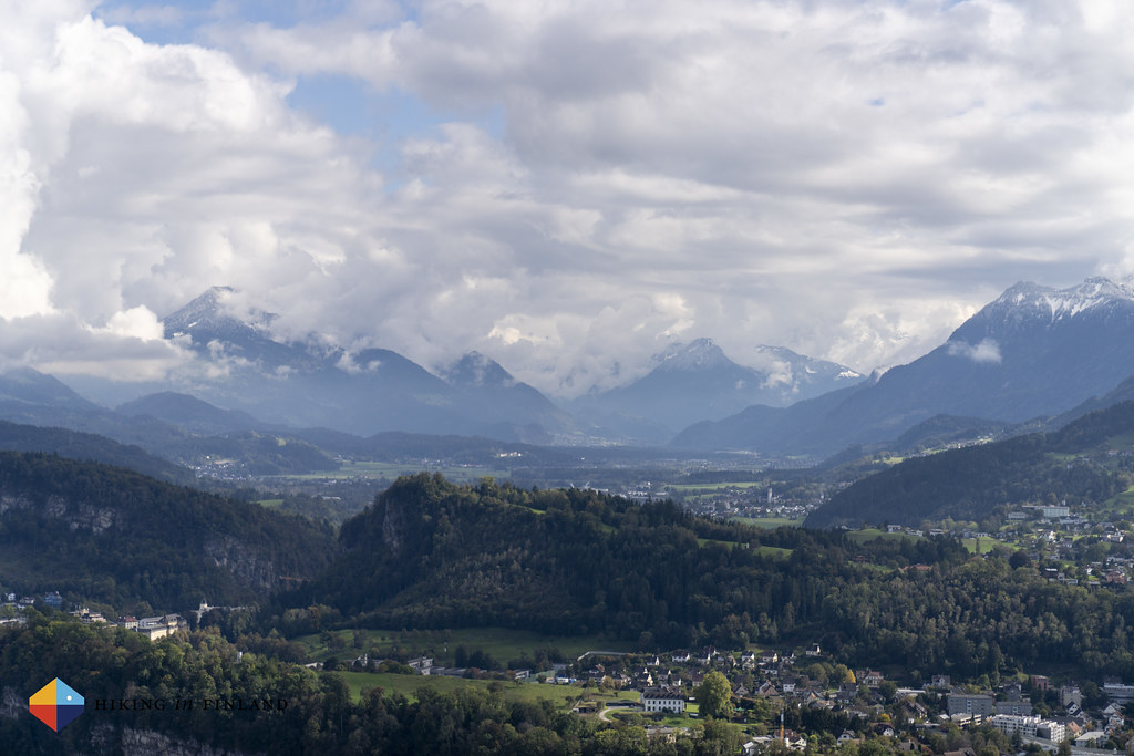
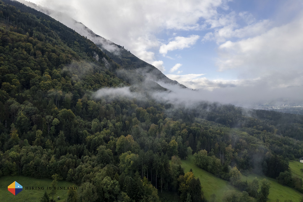
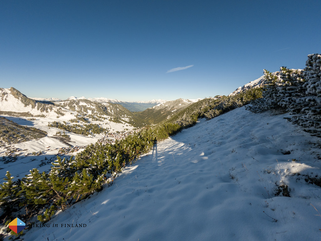
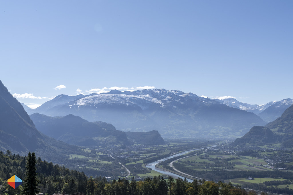
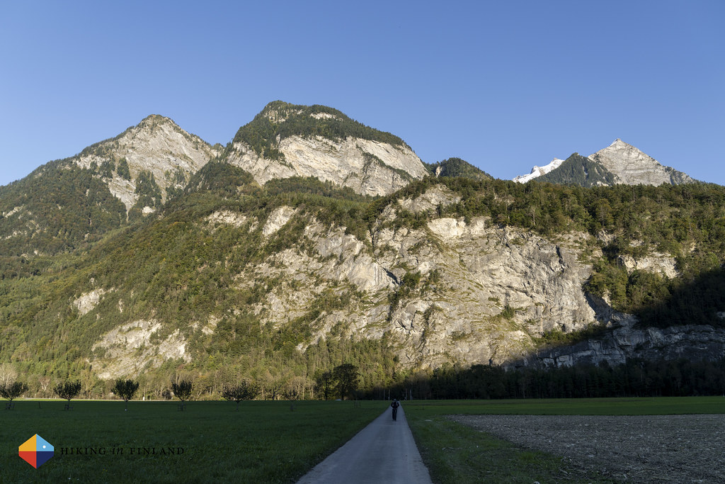
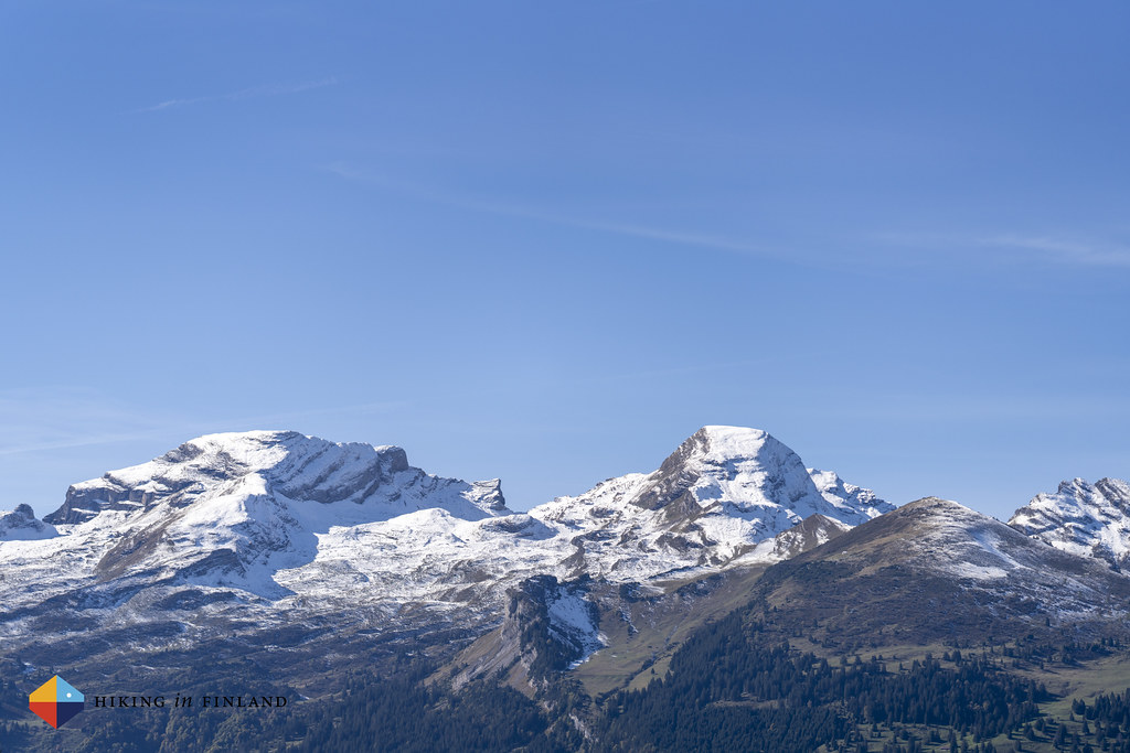
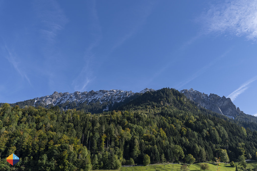
We start to reach the end of our first day while the trail takes us down towards the valley floor, where we hike on a forest road at the bottom of the hill and fields. We can see Ruggell, todays goal, and behind it the Swiss mountains which have snow on what seems to us pretty low elevations. Tomorrow we should hike the first section of the Route 66, which takes us above 2.000 m altitude, and we wonder if it will be possible?

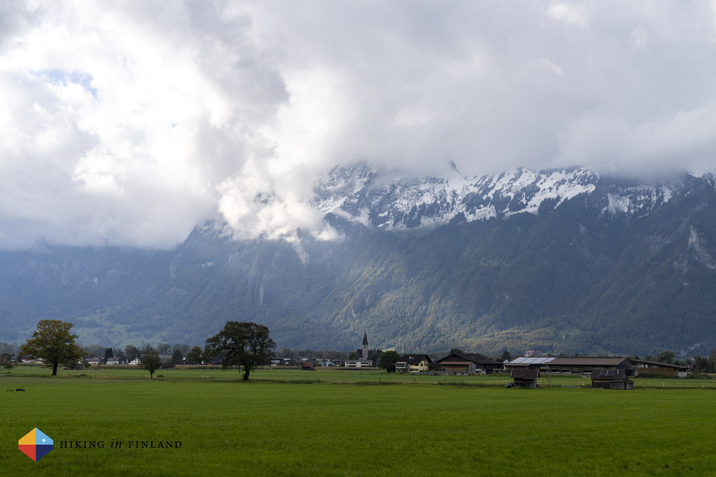
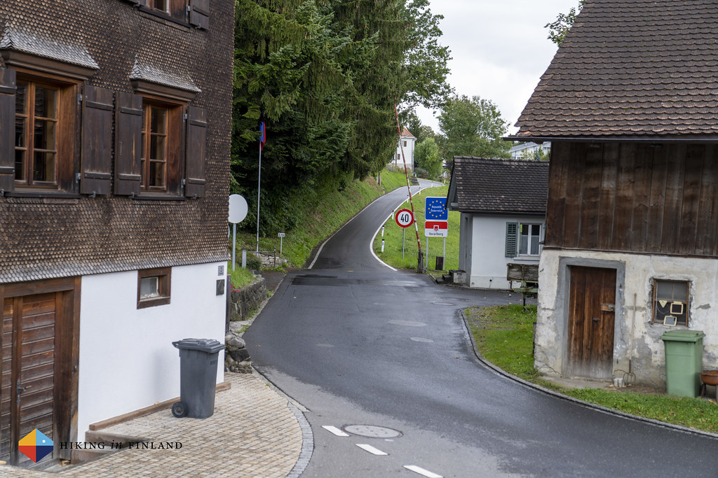
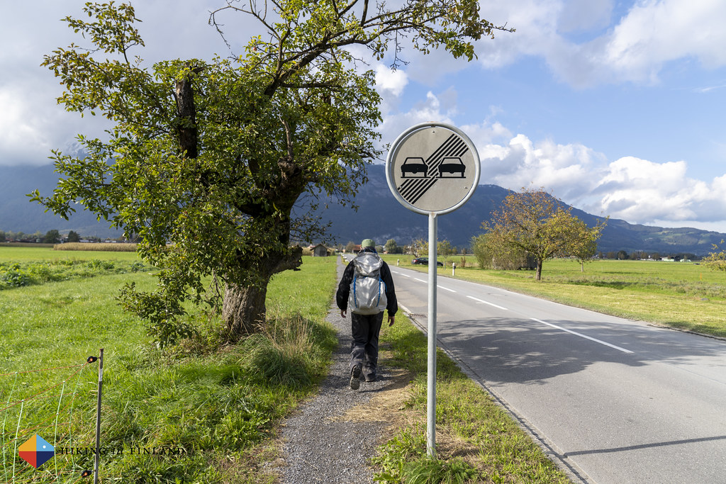
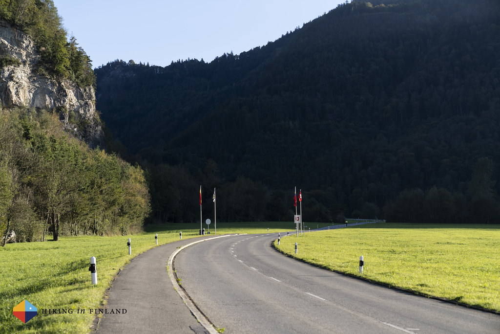
But right now we have some 500 metres more to hike till we reach Ruggell and the end of this section. It goes on the side of a road which sees very little traffic, and after a short while we reach this small town on the border with Switzerland. The next bus goes in twenty minutes and so we decide to walk on till the Upper Rhine, to mark the end of our hike today here at the Border. Less than six hours and 18 km after we have started in the morning we’re finished for the day, and we are both quite happy about the good days walking we had!
Day 2 - Not According to Plan
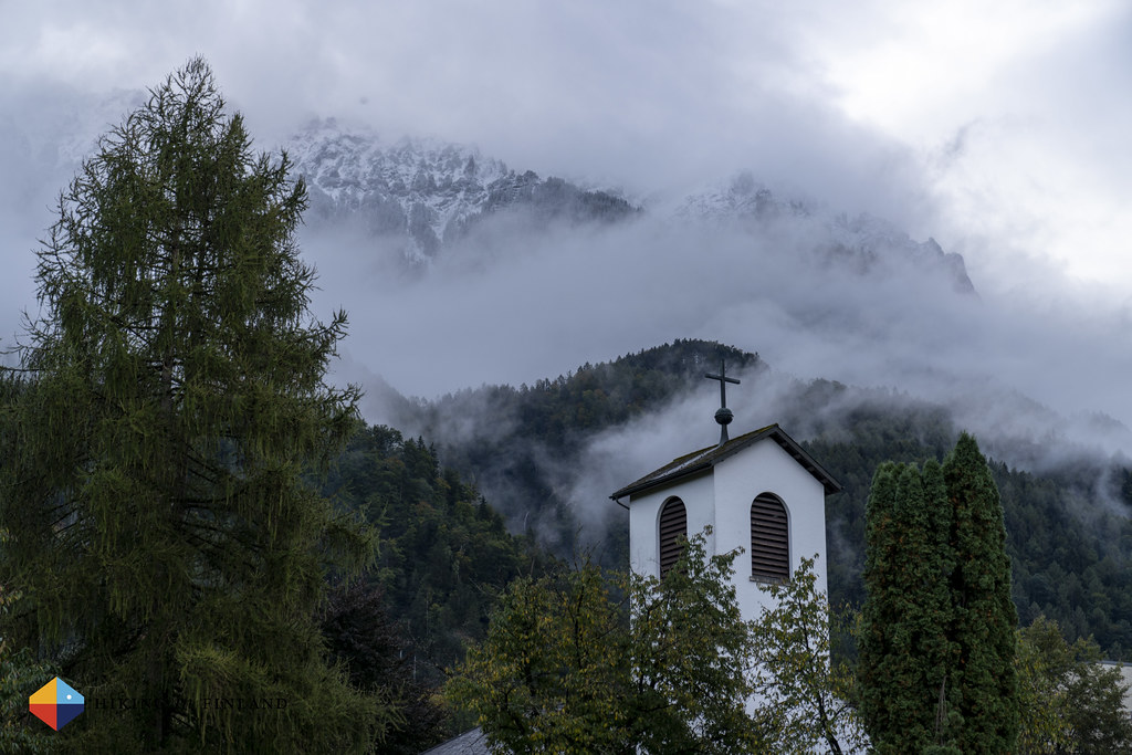
Martin and I meet early for breakfast. Good coffee, Müsli, bread and fruit, then we are checking out of the Hotel and head to the bus stop in Vaduz. Today we are heading into the other direction, and thirty minutes later we arrive in Malbun, a picturesque village high up in a valley. Snow is on the ground and the roofs, but it’s a sunny day, the sky is clear and the forecast is perfect for the next few days, so we are optimistic that today we can hike section 1 of the Route 66. The lift up to the Sareis Station is running and up at the summit the sun is already shining, but we decide to hike out of Malbun and to the start of the trail.


The road up the mountain is free of snow but icy in places, and here in the shade it’s fresh. After a few hundred metres of ascent we reach the start of the trail proper, and some steps from a forest worker go through the snow. We can hear his chainsaw once in a while, but other than that it’s silent up here. Silent, and very pretty!

It’s amazingly beautiful, to be honest. I love winter, and seeing these pretty snow-covered mountains here in October is something which makes me very happy. I smile, delighted by the great conditions, the perfect weather - sunny, warm and with almost no wind - and the possibility to hike this beautiful trail with my best friend.
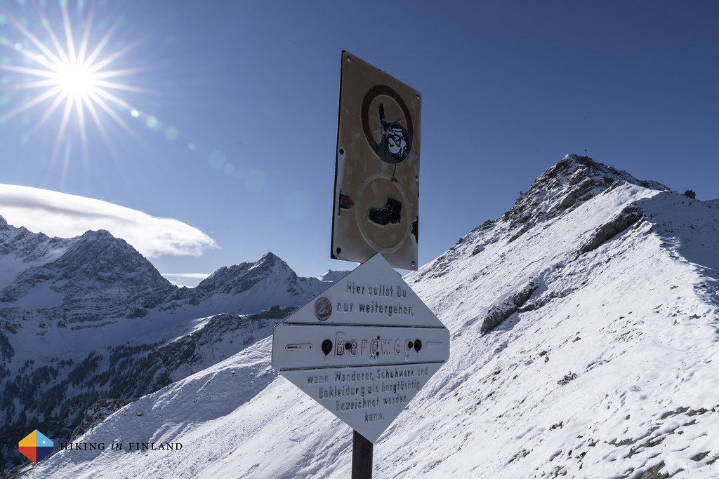
My best friend, however - and I am well aware of this - feels the opposite of me. And I completely understand him. When we reach a sign which warns of the way ahead and that it should only be gone if “Person, Footwear and Clothing are capable of mountaineering” we have a short discussion. The snow goes to the middle of my shins, some 25 cm of fluffy white powder, which hides the trail and its markings ahead. No one has hiked before us, and while we have a map and can follow it via GPS it feels reckless to hike it in these conditions, also as we don’t have an ice axe and crampons along. Martin says that he’s willing to continue and hike on the snowy trail, and for a short moment I am willing to say “Great, lets do this!” but then I know that it’s the wrong answer. We both have wives and kids at home, and the possibility of something happening is always there. With a heavy heart I decide that the right thing to do for us is to turn around and hike another trail in a lower elevation.


It’s disappointing. A beautiful trail. Perfect weather. But with the snow and our lack of the appropriate equipment it’s the right decision. Hiking in these conditions on an exposed ridge has the possibility for things to go bad, and if we have the possibility to hike a safe, beautiful trail in this weather while still hiking through all of Liechtenstein, then this is for us the correct choice.
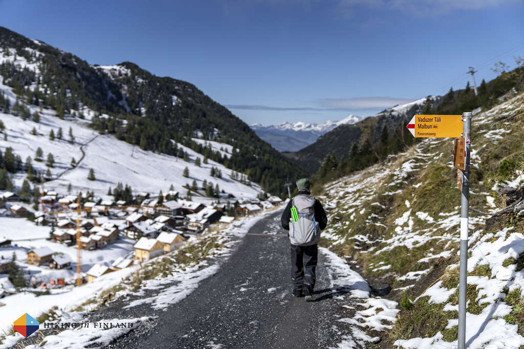
And so we hike back to Malbun. The sun has climbed high by now, and we enjoy the warm rays on our face. In Malbun we only have to wait a moment before we can board a bus down, and after some consideration - we were thinking about hiking through the gorgeous Valünatal valley - we decide to hike the Liechtenstein-Weg, as the section we hiked the previous day is shared by the Route 66 which we were planning to hike. That will mean we will hike a complete trail, just that today we will be hiking from Point B to A, or from Triesenberg to Balzers, to be more precise.
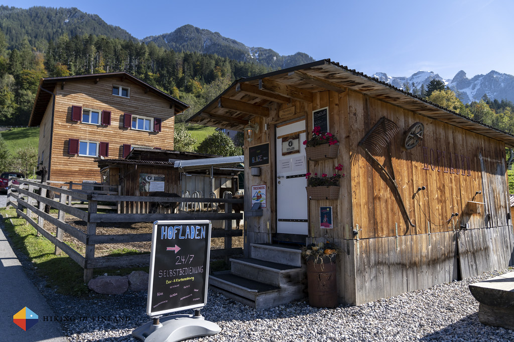
The bus lets us out at the church in Triesenberg. It’s blue sky and sunshine galore, and we hit the trail to Balzers in the south. It’s just 14 km, and as we’re hiking it vice versa we’ll be hiking pretty much only down. I guess doing things the other way around can have its benefits, too! On the way out of town we pass the Lama- & Alpakahof Triesenberg which also has a 24/7 Shop with ice cream and drinks - tempting in such good weather!

We leave the town behind and soon are in the forest, thankful for its shade as it starts to get warm in the sun ☀️ When we reach a viewpoint with a bench we have a break, taking in the view. It is beautiful, and feels like we made the right decision to be here.

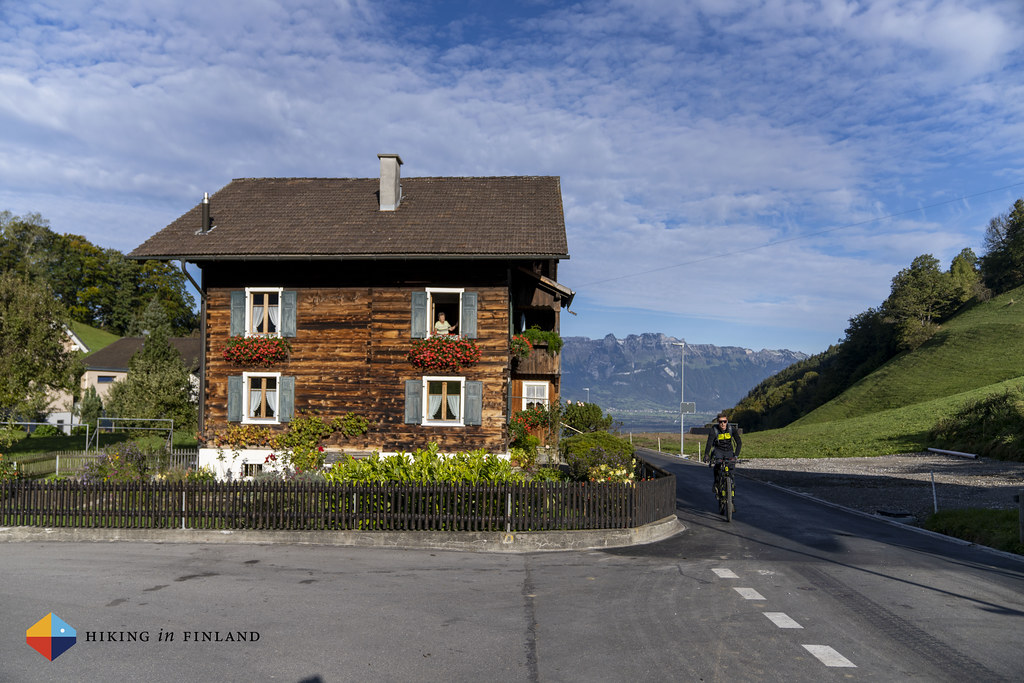
The trail takes us through the forest, meadows and small villages. Beautiful wooden houses line the streets, with flower pots in front of the house. It’s idyllic, and truly pretty to see.


After the village come meadows. Cows are grazing, bees are still flying through the air and wild flowers are growing in the fields. The going is easy and enjoyable, Martin and me talk about life, hiking and food, and that we will have to return to do Route 66 in the summer some time, as above us the mountains look great.


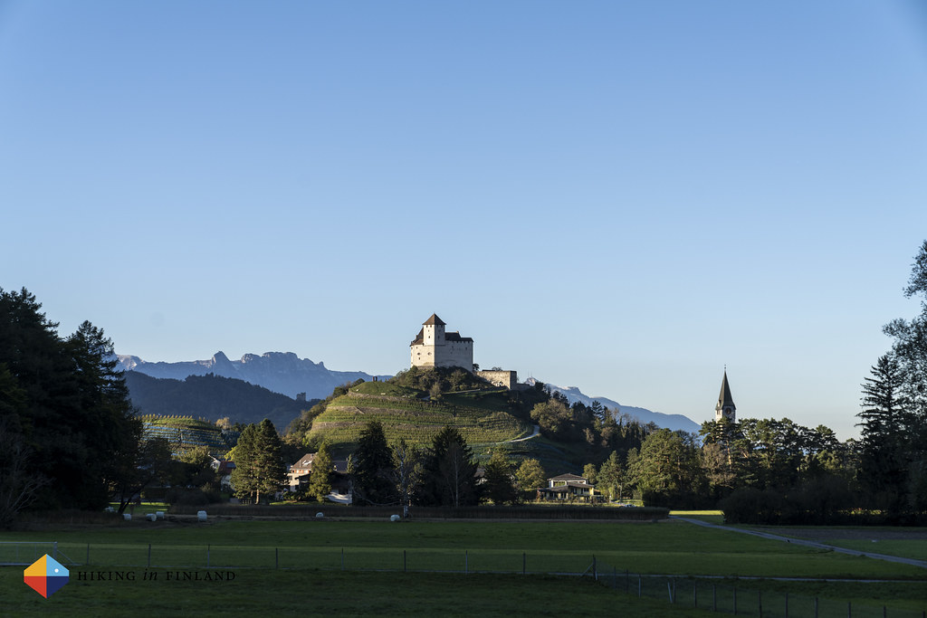
And then, without much warning, we come out of a small patch of forest and see Balzers. Oh, what beauty! On a perfectly shaped hill in the middle of the village sits a castle, with intact towers and walls, framed by the mountains in Switzerland on both sides and the back. It’s a post card picture, and will be the end of todays hike!

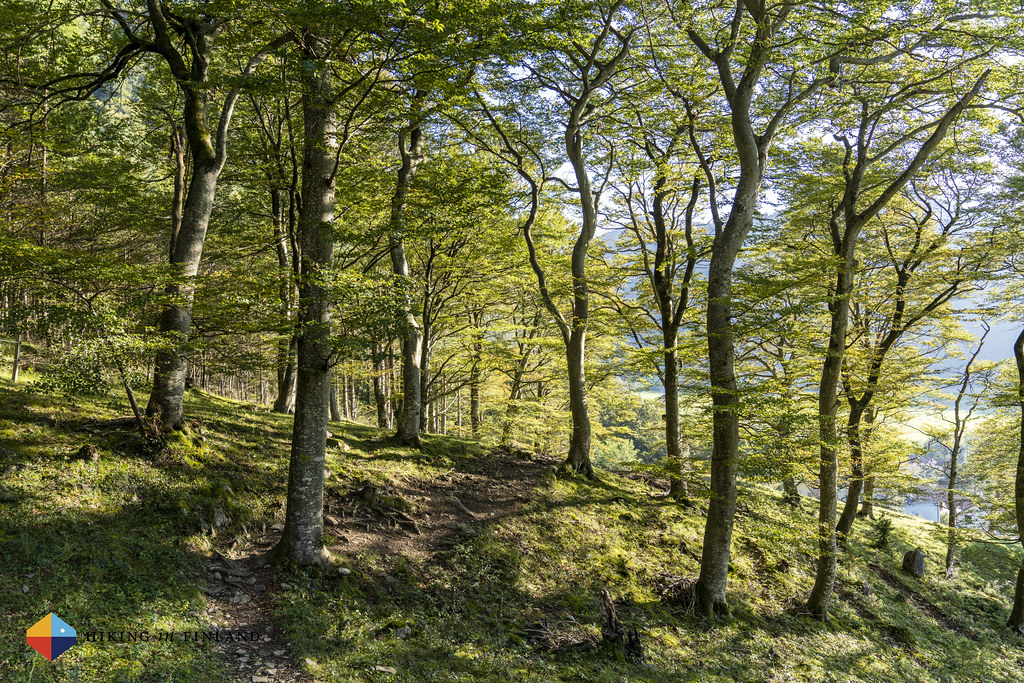
But before that the trail decides to treat us to some single-trail goodness. Much of the hiking in the afternoon has been on nice forest roads, but now we go through light broad-leafed forests on a beautiful single trail. Bathed in sunshine, it’s perfection.
We pass the St. Katharinabrunnen picknick area, again a green space with lots of informative boards wich explain about the ecology around us. There’s a stream making that relaxing gurgling sound, a tiny lake with fish in it, and nice places to sit down (or pitch a tent ⛺️!), though we continue towards the Border with Switzerland.


We walk on a sidewalk (!) to the Southern Border with Switzerland, where flags and signs inform us that here’s the Border. Cyclists ride by, we take a couple of photos and then head onwards towards Balzers. Behind us the mountains are glowing in the evening sun, while on our right the castle Burg Gutenberg stands proudly on its hill in the village. As we walk into the village the Bus stops in front of our nose, so we decide to jump on it and continue towards our Hotel up in Malbun, leaving the exploration of the castle for the future 🏰 😊
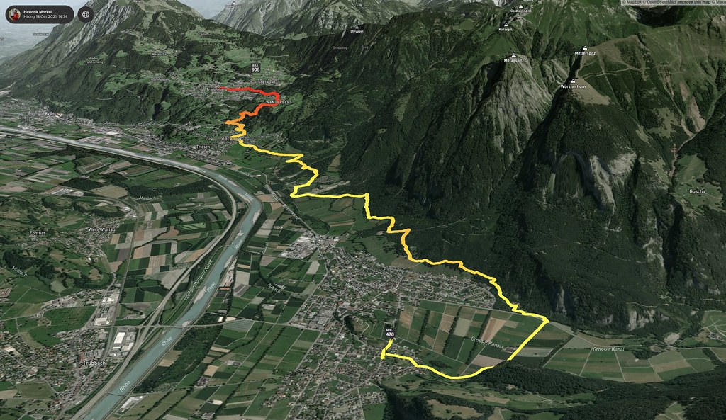
Day 3 - Triesenberg to Nendeln
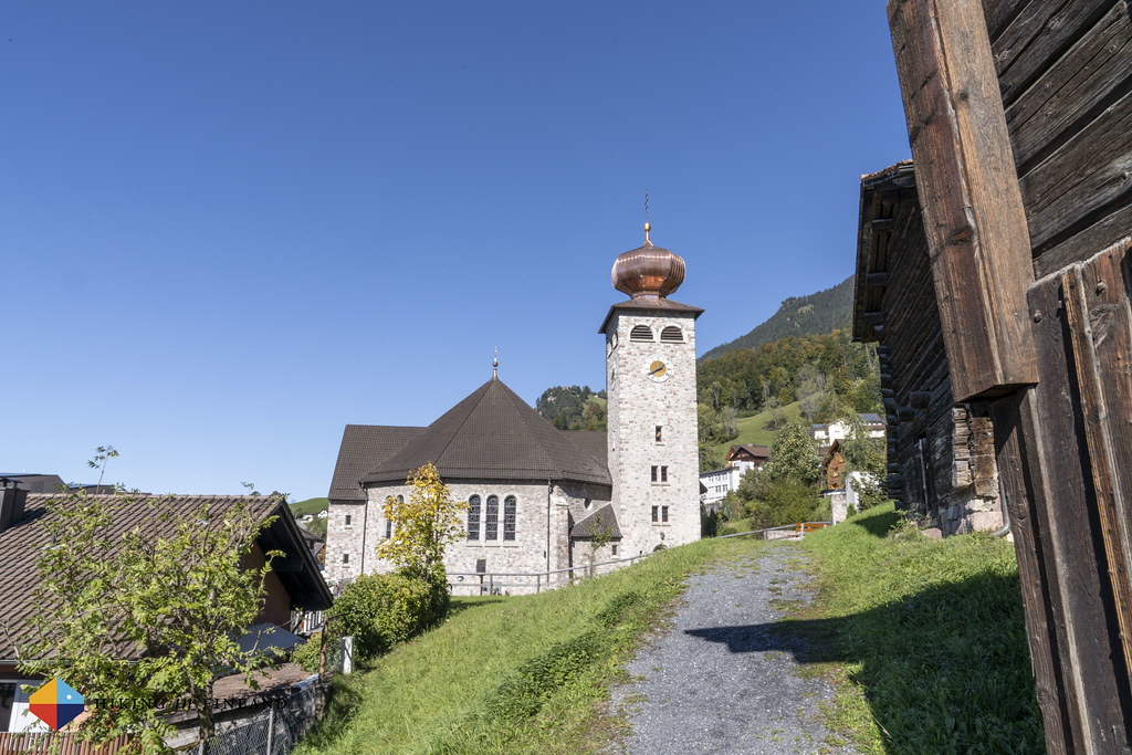
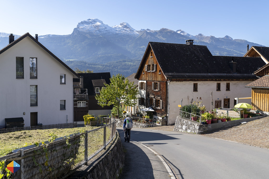
On our third day of hiking on the Liechtenstein-Weg we take the Bus from Malbun - we decided to stay up in the mountains when we planned the original route - and drive down to Triesenberg again. Here we follow the signs and walk out of the village, this time towards the North, and soon we are on the “Walser Sagen Weg Triesenberg” which shares this section of the Liechtenstein-Weg. Cool wooden statues stand besides the trail, along with information boards explaining the stories behind them. Again it’s a sign of quality that you find these kind of great details along the trail - not that the trail is boring, though: The views here are superb!

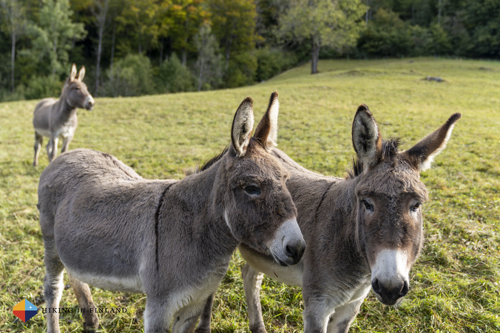
We pass through a small village, again with lovely wooden houses, and start to see quite a few cyclists who ride up the mountain. Mountainbiking seems to be popular here, and there are apparently a few very nice trails running through the forests back down - definitely something to keep in mind for the next visit to Liechtenstein! We pass three friendly donkeys along the trail, who are enjoying the autumn on this meadow with great views, just like us!


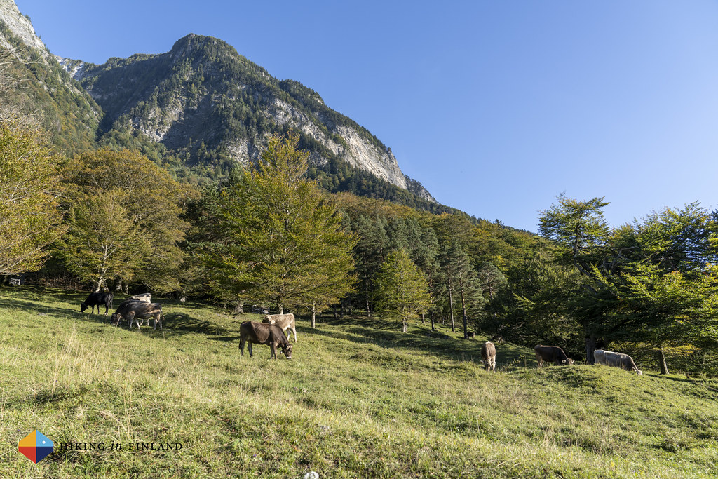
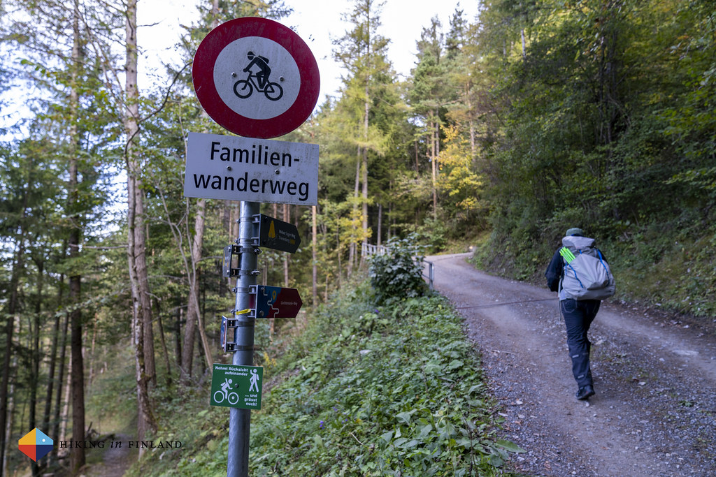
After a while the trail becomes a “Family Trail” - it’s a forest road which is well maintained, and means families with a stroller can hike here without problems. The trail is easy and meanders through the forest and lightly up towards another meadow with beautiful wooden hay sheds, where cows are grazing. The sun is shining in the blue sky, while some cows are grazing on the meadows.

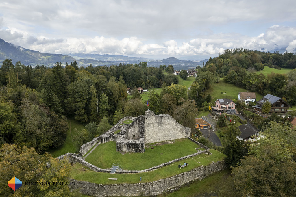
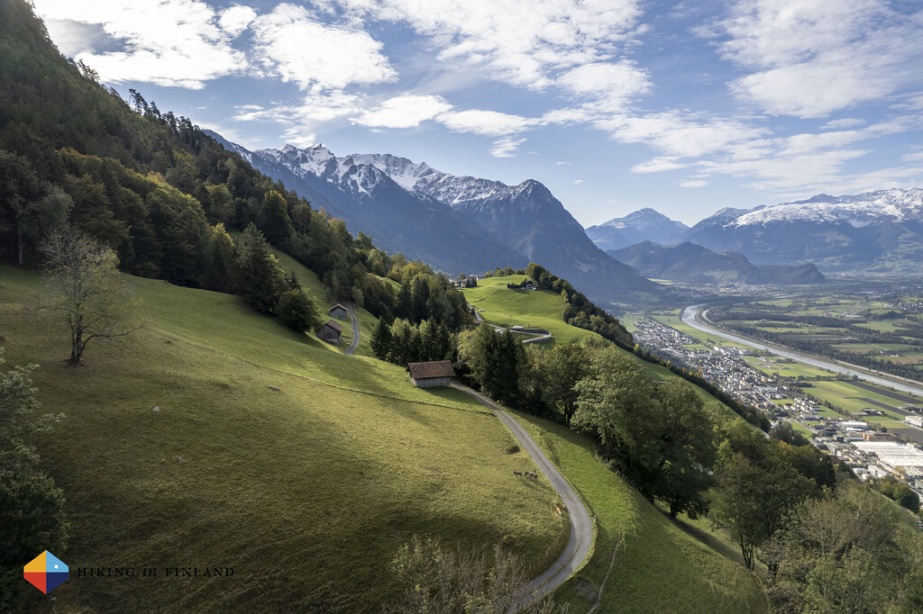
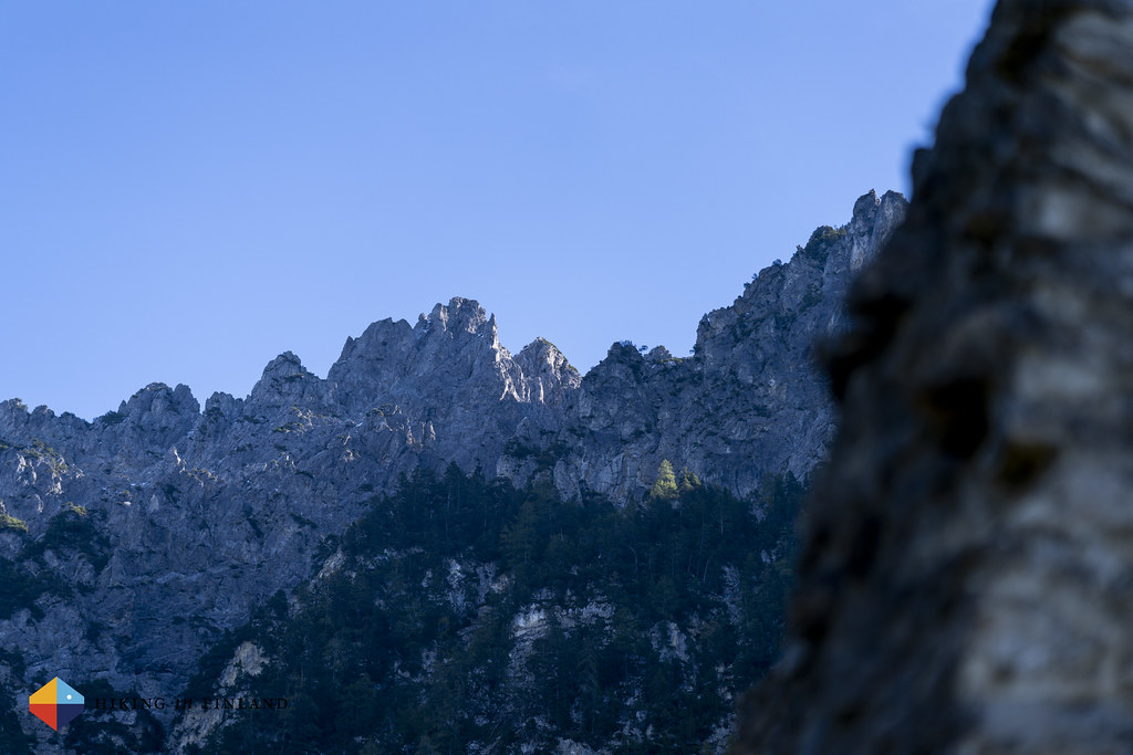
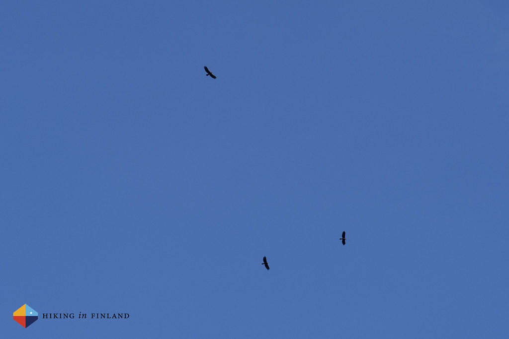
Soon after we reach the Wildschloss, a castle high in the forest overlooking the valley towards the south and north. It’s a beautiful spot, and the bench and table invite us to a break. I get out the 135 mm lens to take photos of the mountain tops, both over in Switzerland and behind and above us in Liechtenstein - that’s where we were supposed to be, if the snow wouldn’t have made things so difficult.

To round out a relaxing break three Golden Eagles (!) are flying high in the blue sky close to the castle ruin. Always a majestic sight, we are delighted to see three eagles who are circling higher and higher on the warm air rising up. After coffee and cookies in the sunshine we pack up and continue on the trail, which leads us now through the forest towards the valley on a nice single trail. We pass one of the channels where in the spring the melt water rushes towards the Rhine in the valley, and can just imagine the amounts of water that must come down here in the spring, judging from the amount of rocks in it.


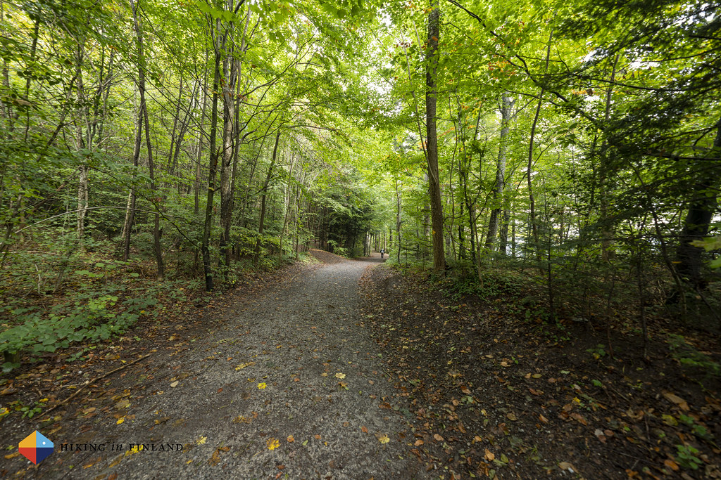
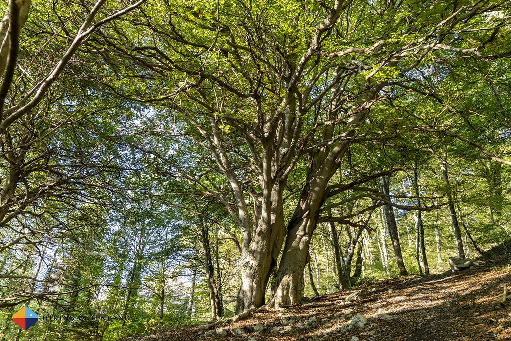
Past a green field which again looks perfect for pitching a tarp we soon are on one of the beautiful single-trail sections. It’s the kind of trail that’s perfect, under a pretty broad-leaf roof and with soft pine needles and roots making for enjoyable walking.


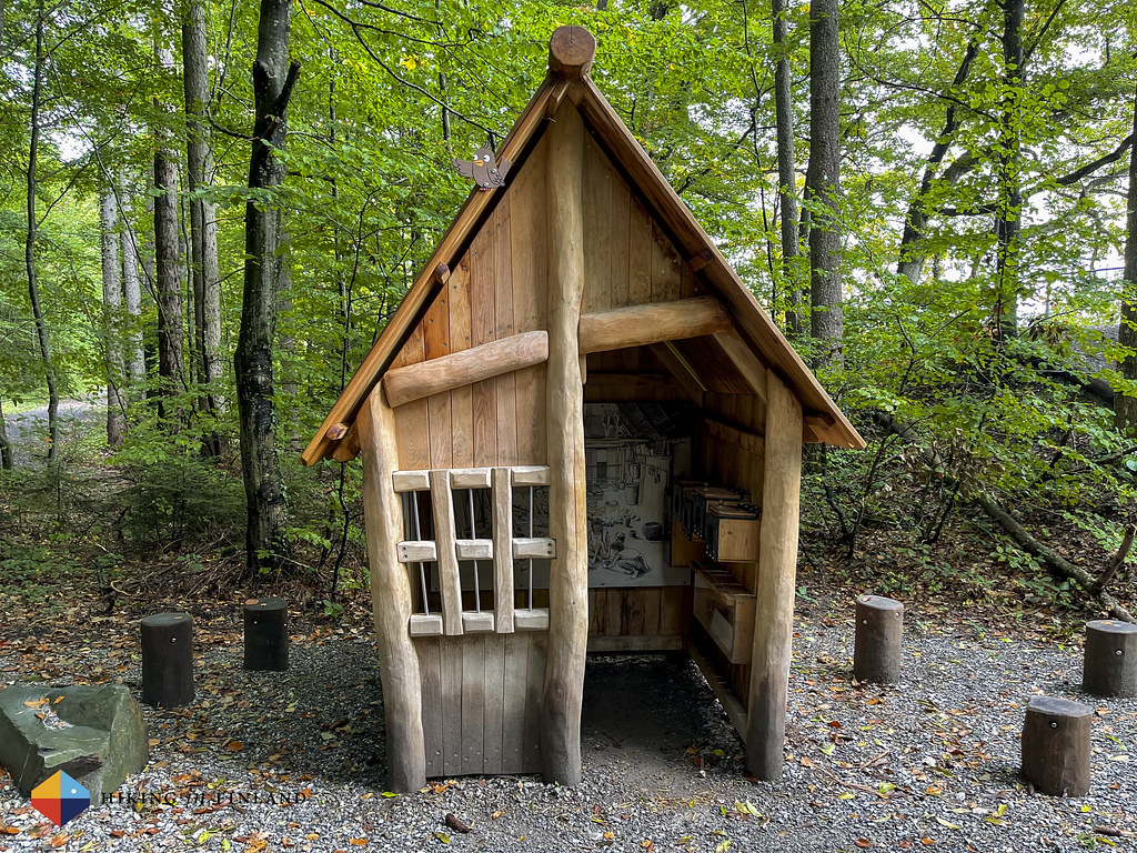
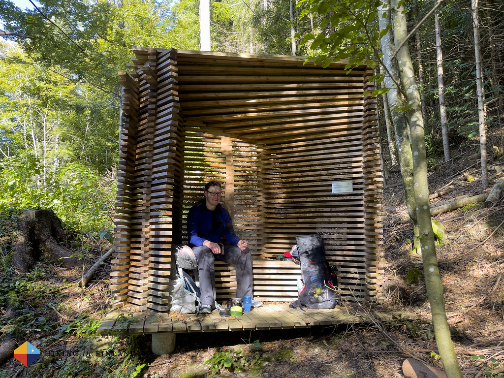
After we cross a road we find a very pretty break hut, which was made by two young wood workers. We decide it’s time for another coffee and tea break, as soon we’ll enter onto a section of the trail which goes through more civilization. So we sit down here in this hut, in the forest, and enjoy another cup of tea.
Even the little huts at the bus stops in Liechtenstein are absolutely photogenic, as we witness in the village of Planken, which we reach next. Ripe, delicious-looking apples hang on the trees, and we can’t resist to pick one as a snack - there’s nothing better than eating a tasty sweet apple when hiking!


We stroll through the village of Planken and reach a very scenic view point, where we meet a few other people who take in the view. Over on the Swiss Mountains 🇨🇭⛰ we see that the snow has melted - behind us, however, there’s still snow on the tops, a reminder of our adventure from yesterday.

And then we leave the views behind and start the final descent into Nendeln, the village where we started our trip a couple of days ago, and which will complete our thru-hike of the Liechtenstein-Weg: Hiking from the Swiss Border in the South through all of Liechtenstein towards the Northern Border with Austria and Switzerland. It was an inspiring hike through a beautiful little country, with beautiful scenery and on well-maintained trails. The autumn weather was beautiful and after we returned home we saw on the Liechtenstein Social media channels that the great weather continued for several more weeks, so the fall hiking in Liechtenstein can be enjoyed for a long time - after all, most of the broad-leaf trees hadn’t even started to go yellow, orange and red! Martin and me decided to return in the future and hike the Route 66 from start to finish - without snow! But then there’s also great family skiing in this small country… ❄️🏔⛷


Practicalities - Where to Stay, What to Eat and How to get Around
We stayed a couple of nights in Vaduz in the Hotel Vaduzer Hof which had very nice and spacious rooms with good views over the town, a very nice Sauna and a good breakfast buffet. It’s right in the centre of town and a good location to go visit Museums or go to the bus stop to catch a ride to the various trails.

We spent one night at the Hotel Turna in Malbun, which was lovely - great service, tasty vegan food and a nice Sauna area for relaxing after a day of hiking. Kids will love the swimming pool and play room!

Wild camping in Liechtenstein is illegal. If you hike Route 66 in summer then there’s three mountain huts at which you can stay. We sadly weren’t able to visit none of them (we had planend to visit the Pfälzerhütte and Gafadurahütte on the Route 66), but they look absolutely lovely.
In Vaduz there’s plenty of great restaurants where hungry hikers can dine. We ate very tasty vegan Sushi at the Café im Kunstmuseum and very good (vegan) Burgers at the Brasserie Burg. There’s no shortage of other restaurants so just use Google Maps to find the place you want to eat at! In Malbun we ate at the Hotel Turna which had delicious seasonal food, the pumpkin soup is highly recommended 🎃!
In Vaduz we also visited the Liechtensteinisches PostMuseum and the Liechtensteinische SchatzKammer, though there’s also an art museum and more to get a taste of the local culture. A hike up to the Schloss is great to get a feel of the size of the country, and you also can hike to and along the Rhine easily from Vaduz.

You can get around in Liechtenstein via the LieMobil busses. You can buy a ticket in the Bus or at the service centre in Schaan. There’s also a Bike-Sharing System in place if you want to ride around yourself. We used Google Maps for bus schedules, which worked just fine.

We came and left Liechtenstein via Bus and Train. The Swiss trains stop e.g. in Sargans from where you can hop on LIEmobil bus, while across the Northern border you can get a Austrian train in Feldkirch. It’s easy to get to Liechtenstein from abroad by flying in to Zürich and then using public transportation to get here.
Recommended gear
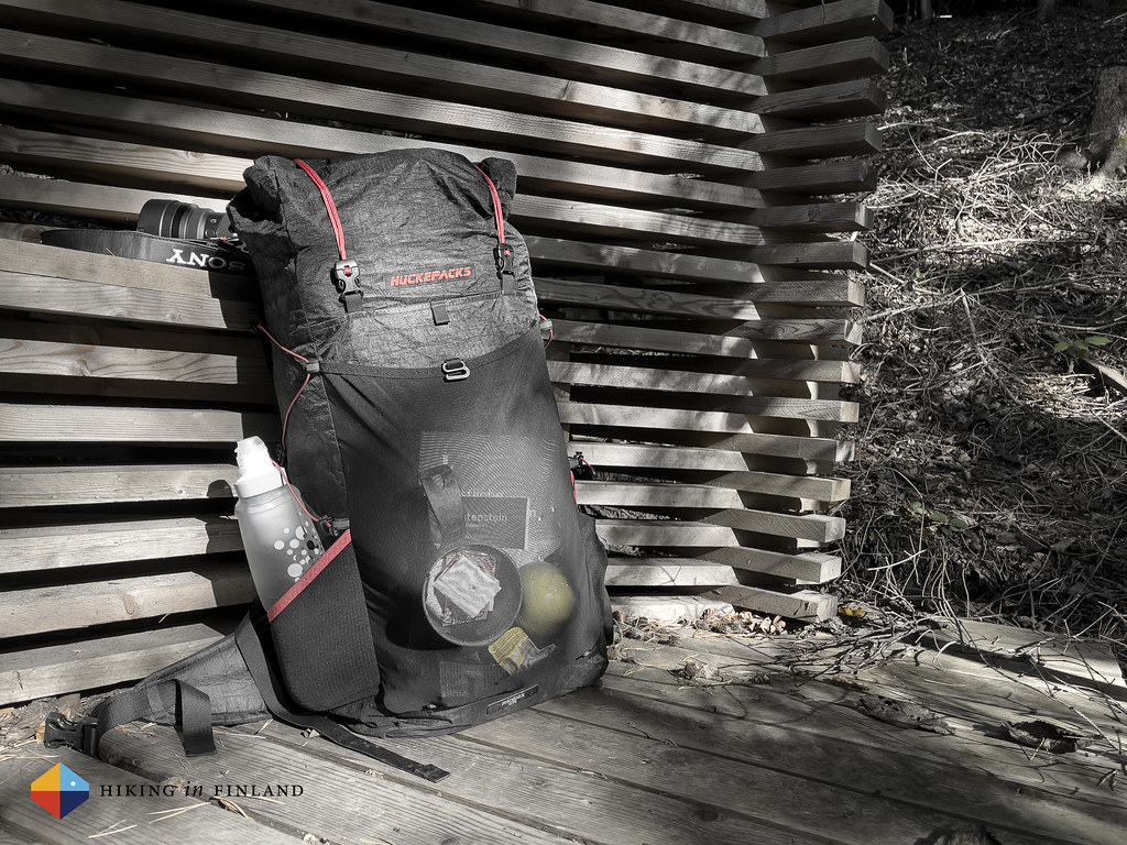
You really only need day hiking gear when you’re hiking in Liechtenstein, though my Gear Checklist for Backpacking Beginners is a good start to get an idea on the garments, backpack and other kit you might need. We had a stove along to make coffee and tea during the day, water bottles and ∞ BeFree water filter and a small emergency kit. I carried everything in the Huckepacks PHOENIX Lite.
I hiked in my inov-8 RocLite G 275 Shoes and my standard hiking outfit of a ∞ Houdini Activist Tee and ∞ Black Diamond Alpinist Hoody on top, Houdini Motion Pants on the bottom. I had my Patagonia R1 Air and a ∞ Patagonia Micro Puff Jacket along for insulation, and a ∞ Klättermusen Asynja Jacket and Pants against the rain 🌧.
The next time I would try the Route 66 in autumn I’d take an ∞ ice axe, a ∞ light harness, a ∞ short rope and some ∞ spikes along. This is not necessary but would add a layer of security, especially if you’re out with someone who does not feel comfortable in exposed terrain - and obviously the other person would be carrying the same equipment minus the rope, too.

For navigation we used… our phones! Both the Route 66 and the Liechtenstein-Weg have great maps available on Outdoor Active, which you can use for free when out and about. I don’t know if it’s really necessary as the different trails in Lichtenstein are superbly marked by sign posts at all crossroads in between, but as it is free and you have your phone alonge either way, why ot download the app and tracks and make sure you know where you are.

I carried my usual camera gear and my drone, as well as a GoPro HERO 10 - which means you can expect a Video of this trip coming soon! I guess I should make an article about the camera gear at some point, too 😊
In conclusion
Our hike on the Route 66 and the Liechtenstein-Weg was a delightful adventure with it’s ups and downs. Sure it’s disappointing to not having been able to hike the original route, but it’s a sign of the possibilities in this small country that you can quickly adjust your plans and hike an equally exciting trail. The Liechtenstein-Weg was a beautiful trail with great views, interesting sights along the way and which brought us through many different natural environments - from high alpine mountains to green meadows, lush forests, small, quaint villages and to the Upper Rhine river! The weather was beautiful, we saw exciting wild life, made breaks in impressive castle ruins and hiked through a complete country from South to North - what else can you wish for from a hiking holiday?!

If you enjoyed this article buy me a coffee. You also could subscribe to the rarer-than-ever Newsletter and follow along on Twitter and Youtube for more outdoorsy updates!