There are trails which are so full of spectacular natural scenery that the going is slow, because you stop all the time to take in these amazing views and observe the details. Route 2 of the Mullerthal Trail is such a trail, and I recommend that you take your time to enjoy this beautiful trail with all it’s wonderful viewpoints and inspiring rock formations.

Disclosure: This trip was supported financially by the local Tourism office. There are Affiliate links in this article which are marked with an ∞ Infinity Sign 😊 You can use these AT NO EXTRA COST TO YOU but I get a small provision from the company. As you know: I’m keepin’ it real and tell you how it is - I maintain full editorial control of the content published on Hiking in Finland. Read the Transparency Disclaimer for more information on affiliate links & blogger transparency.
tl;dr
Don’t want to read and are more the viewing kind-of-type? Grab a ☕️ and put the Video on in 4K and enjoy!
Day 1: Echternach - Berdorf - Heringer Millen
After we hiked the Mullerthal Trail Route 1 in completely terrible weather, on the morning of our third day the sun is shining, some clouds are slowly moving across the blue sky and it is a nice, warm 15°C outside. It’s exactly the kind of weather you want when you hike Route 2 of the Mullerthal Trail. This is THE Route of the Mullerthal trail, with one scenic spot after the other. Which means, if you’re a photographer like me, the going will be slow 😆
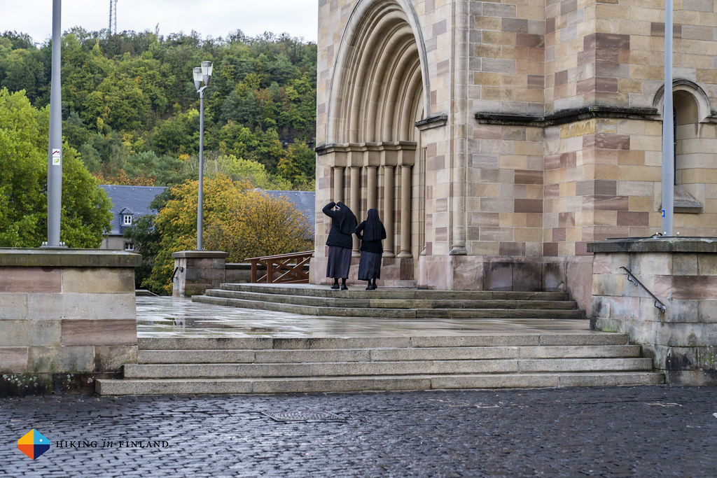
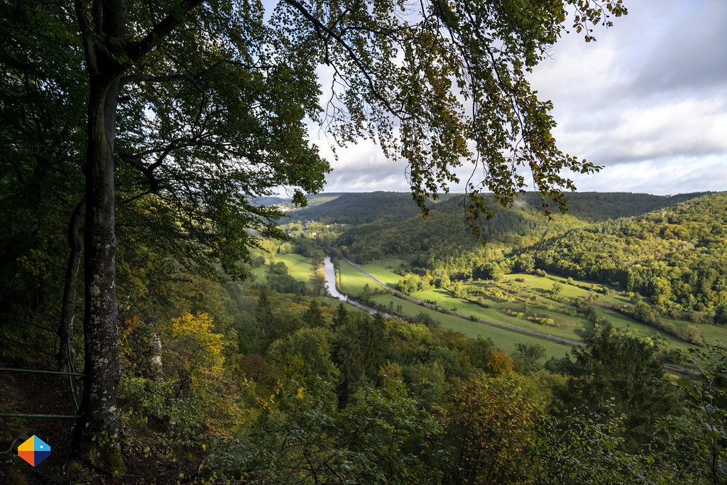
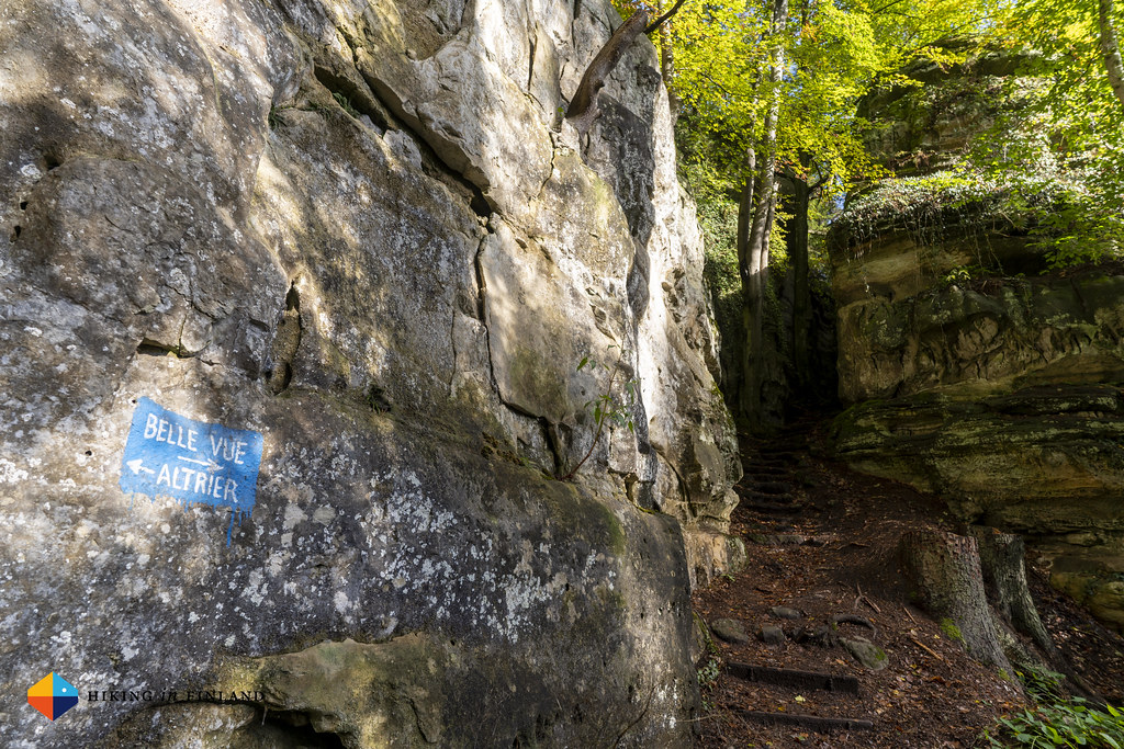
We left Echternach on foot and soon passed the Troosknäppchen view point, where we took a look back on the town which was out home the past three nights. Our luggage will be awaiting us at our next home for the night, so we can hike with light packs on the trail.
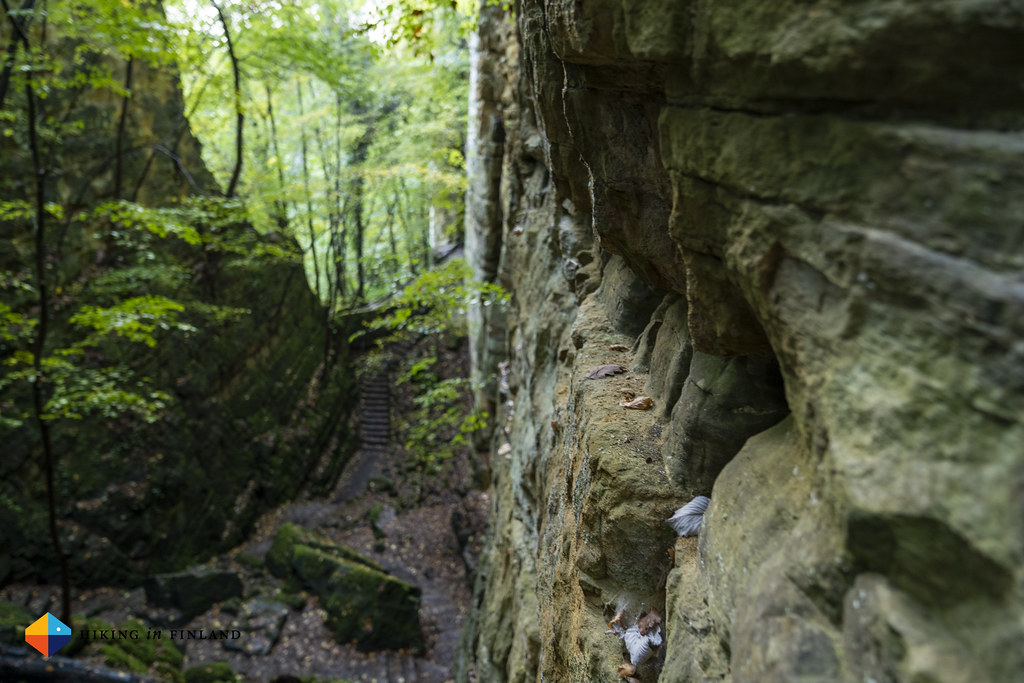
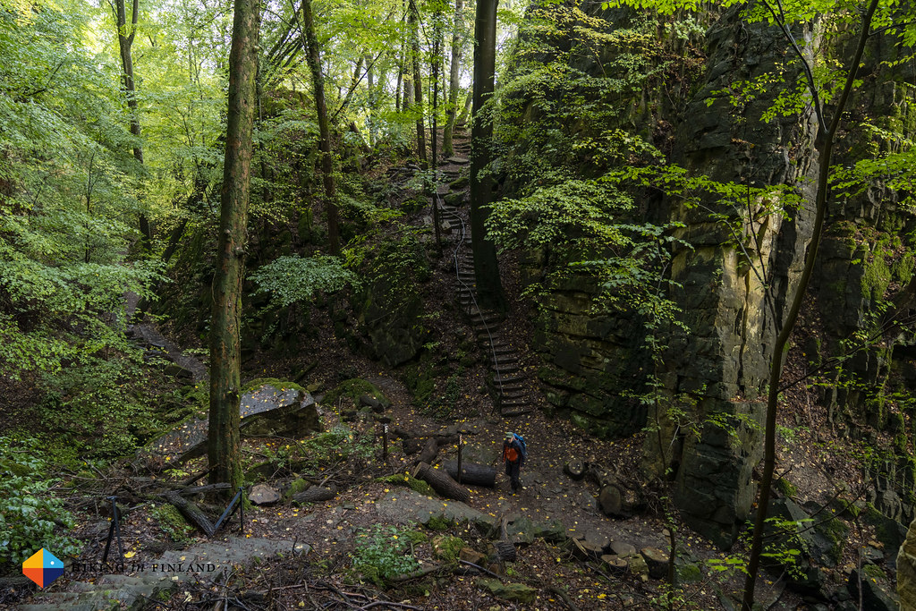
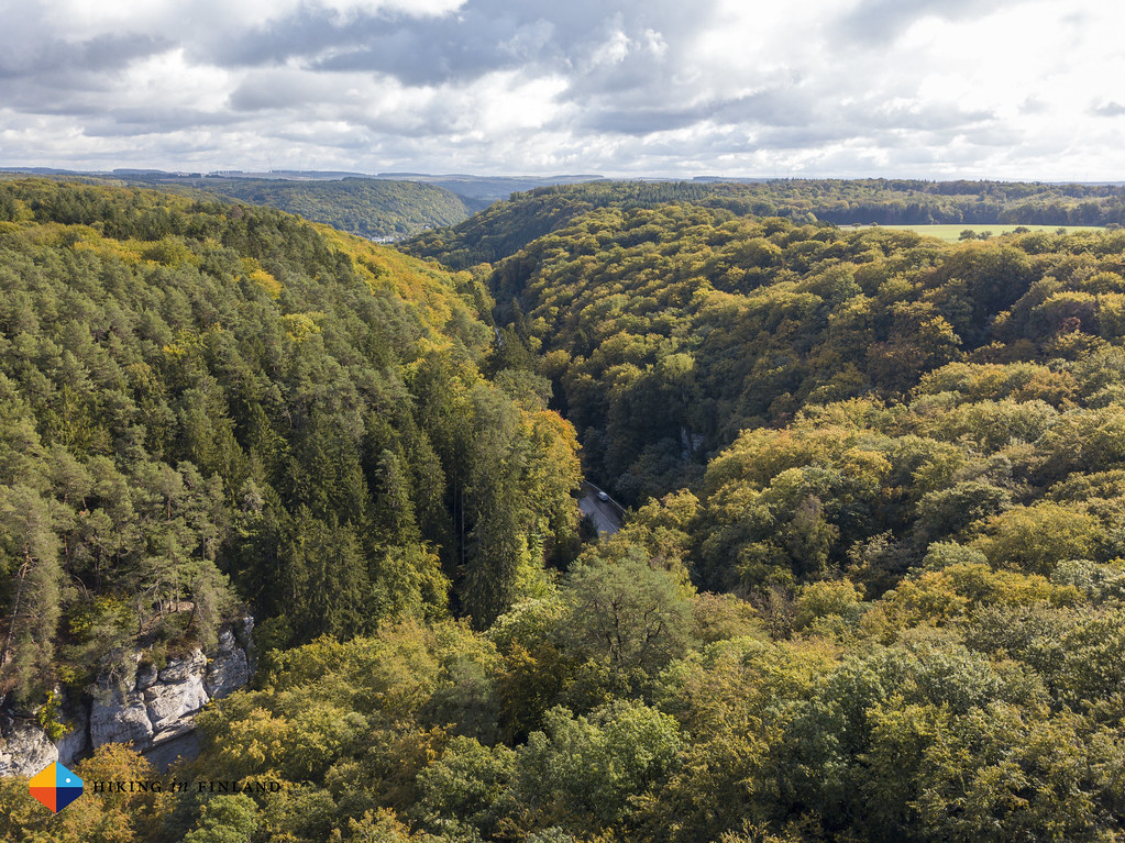
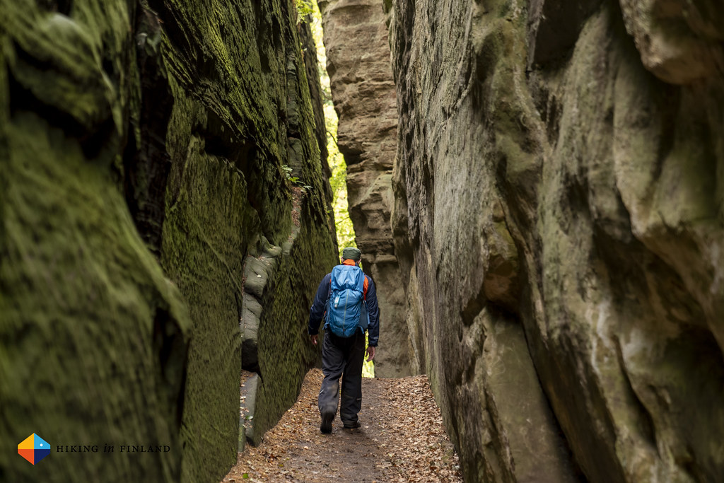
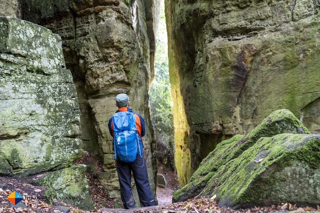
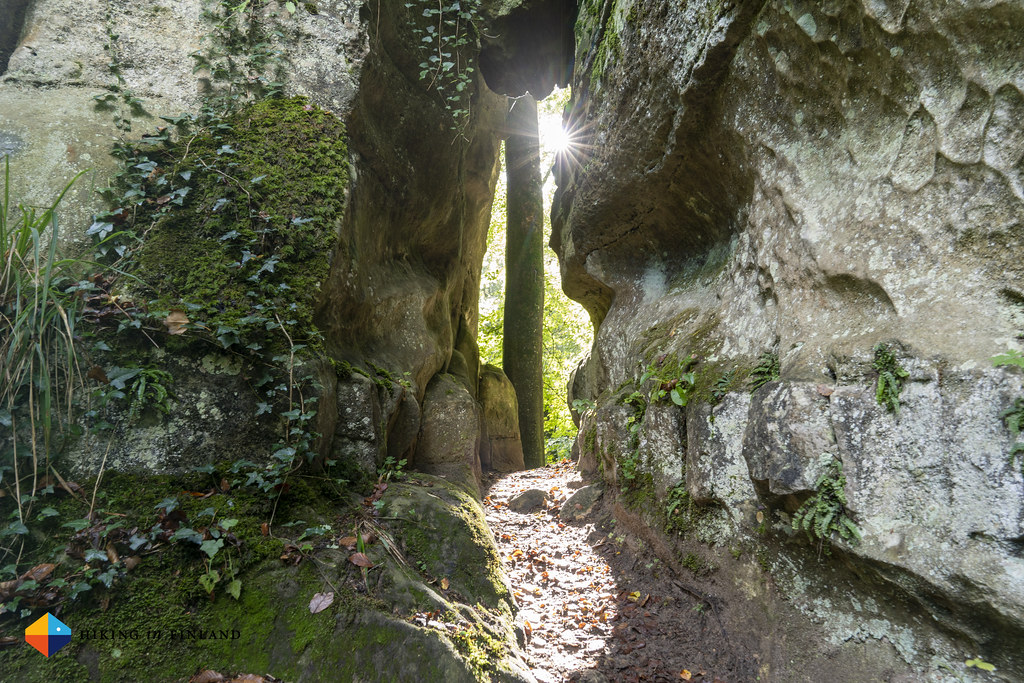
The trail goes along the left side of the valley, on the other side of it and the river is Germany, literally a stone throw away. The trail gives nice views on this valley, and the interaction of sunshine and clouds is pretty to observe. It does not take long and we are at the first scenic viewpoint of Route 2, the Wolfsschlucht, a steep canyon in which in past times wolves were hiding. It’s an impressive sight and we enjoy it a lot, but are surprised that after you have climbed the hundreds of stairs there’s a small cauldron from which stairs go further up on both sides. We climb both sets of stairs and are rewarded by beautiful views on the valley, with sunshine on our faces ☀️


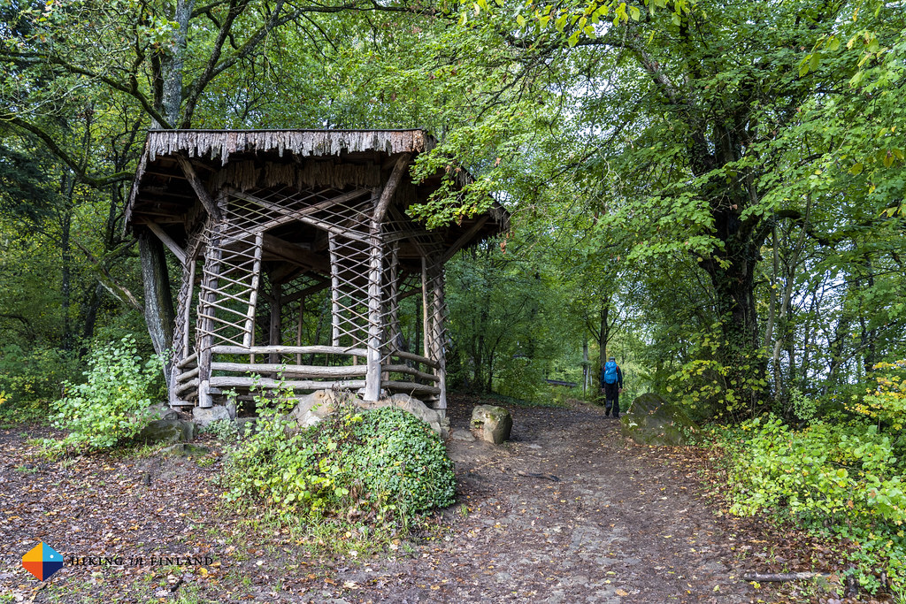
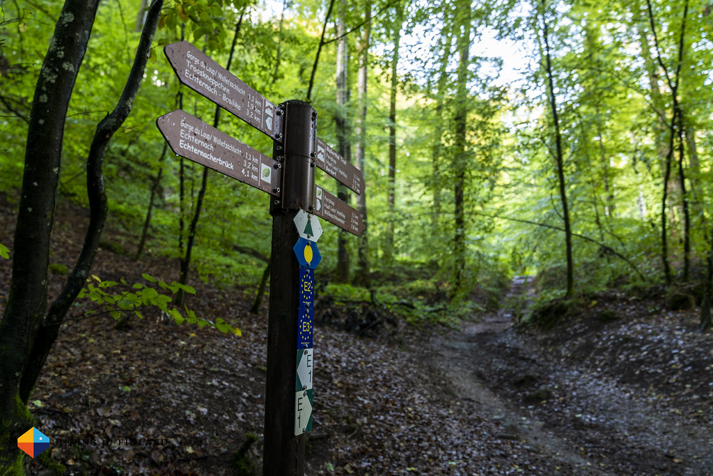
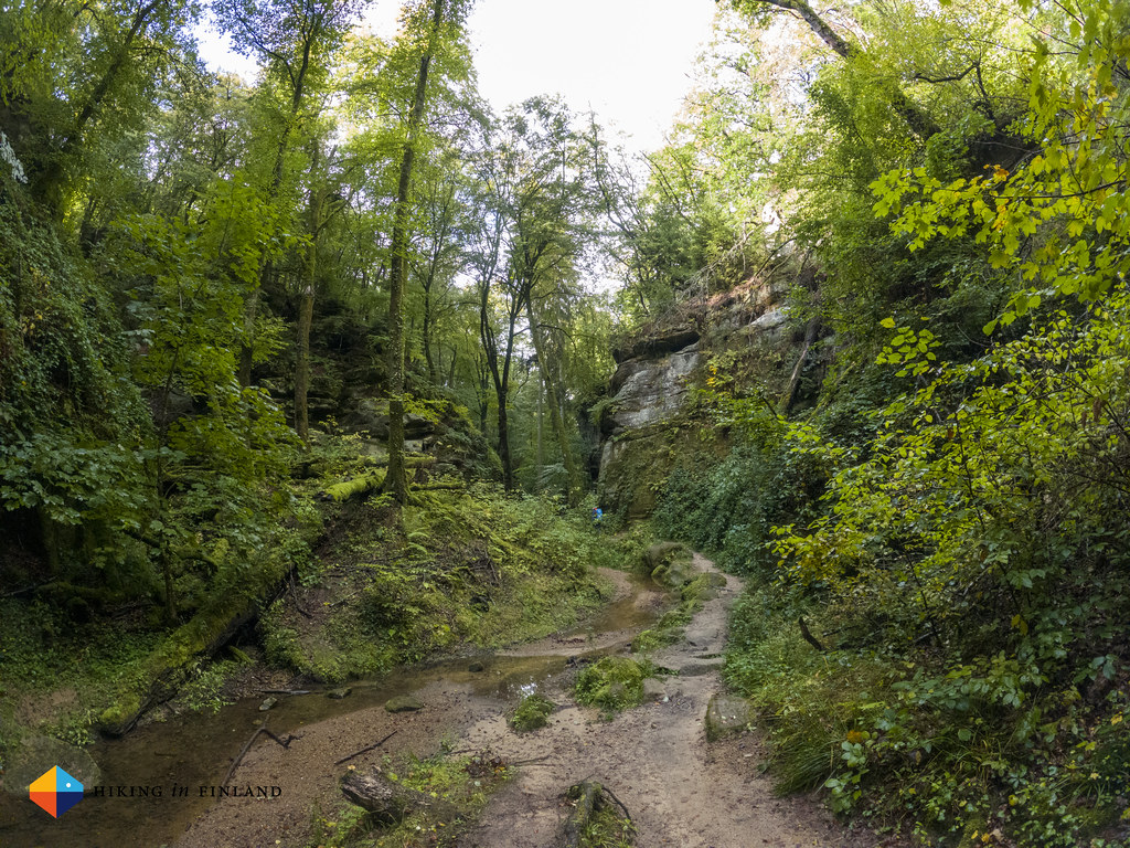
The trail goes on past moss-covered rocks and green beech trees, stairs down, over little bridges, impressive rock walls. A pair of Dutch hikers pass us and ask if we know where the “Labyrinth” is - which is the next highlight, and which was just a few hundred meters ahead of us =)

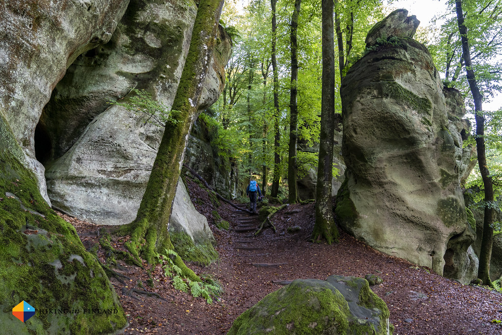
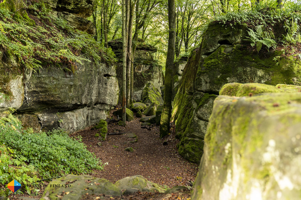

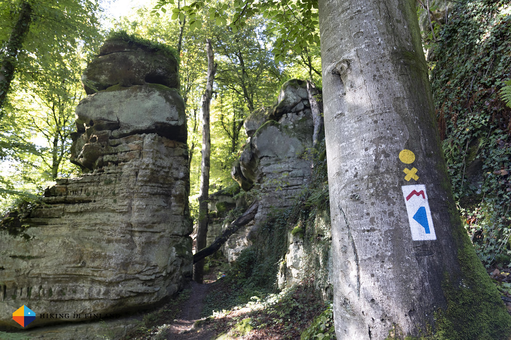
The Labyrinth is described as “a maze of rocks” but the truth is that i’s less a maze than just a bunch of rocks where the trail goes through. It’s pretty, nevertheless. For these 3 km we already needed more than an hour, because of all the photo and video breaks. We arrive at the Perekop viewpoint, and decide to not go climb it - but I briefly let the drone go up and snap some photos from up in the air. The trail now leads away from the road and deeper into a forest canyon, where we go over half a dozen bridges which go over a small stream.
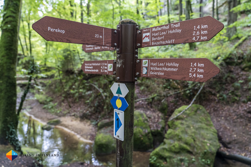

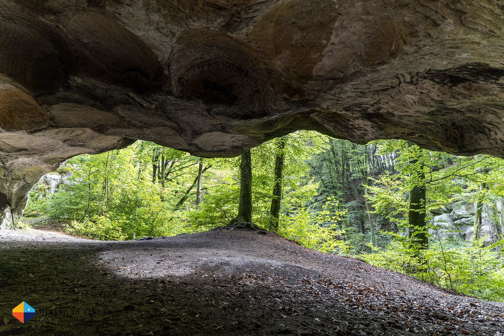
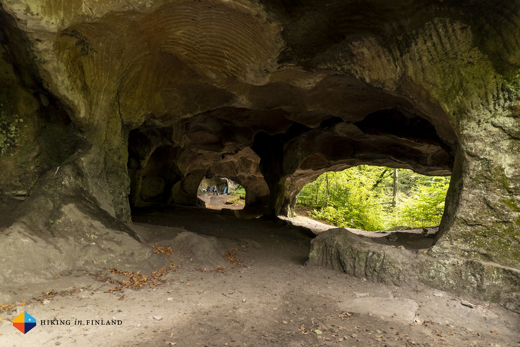
We climb some stairs and then stand in front of the mouth of the Huel Lee cave. This is a really popular spot but the moment we arrive the only other being there with us is a small stray cat, which miaus at us. Huel Lee is a cave where the local mill stones were “broken” from the rock, which generated this large cave. It’s a beautiful sight, and later on we learn that this is the only place where the rock quality was right for mill stones. I take a lot of photos while Martin talks to the cat, and as we leave we try to guide it with us back to Berdorf, but the wee cat decides to stay at the cave. We hope it will be well, and walk on.


It’s three hours after we have left Echternach that we arrive in Berdorf, which amounts to around 2 km of speed per hour. Yeps, that is REALLY slow.

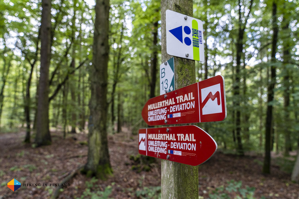
In Berdorf we head into the Trail-Inn Café & Restaurant. We order some coffee and some absolutely fantastic cake, but as I order the bill we’re a bit shocked to pay 20€ for two coffees and pieces of 🍰! As we leave Berdorf Martin and me are very much looking forward to the next section to the Müllerthal, there’s a lot of scenic spots along this section of the trail. Sadly we soon find the trail closed and a Detour sign - a flood destroyed the bridges here, and currently the final bridges and paths are put into place.
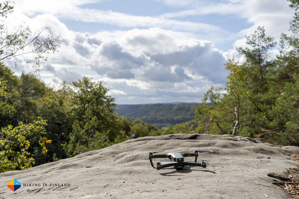
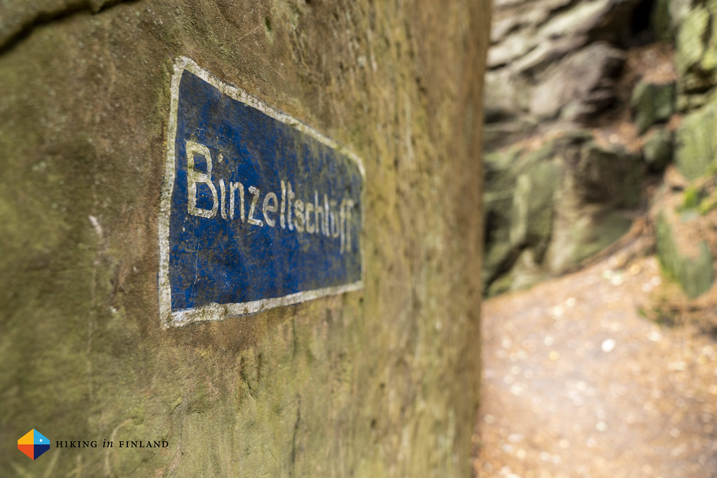
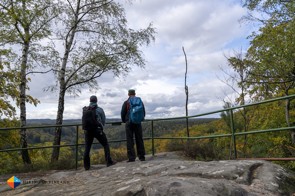
This detour at least speeds us up considerably, and it’s also really pretty. We’re high above the normal trail and can get (careful) glimpses of the scenery down in the valley where Route 2 would take us along - we guess we’re between 30 and 50 m high up, so standing at the lip of rocks is scary. Not long and we’re at the Binzeltschlëff rock formation, which throwns above a road which is very silent. I fly my Drone again, and then we cross the road and Martin and me climb and squeeze through the Priedegtstull rocks. We laugh a lot here, it’s something we don’t usually get to do and if our kids would be here, they’d love it as much as we, we realize!


As we arrive at the top we realize that we definitely took the most adventurous detour through the rocks, as there also would have been a very easy path up here. But probably it was a lot less fun than our route! We take a look over the land from the viewpoint, and then dive into the forest.


The weather is perfect for a day of autumn hiking, with a light breeze and beautiful sunshine.
At one rock formation the sun reflects beautifully onto the rocks, painting them golden.

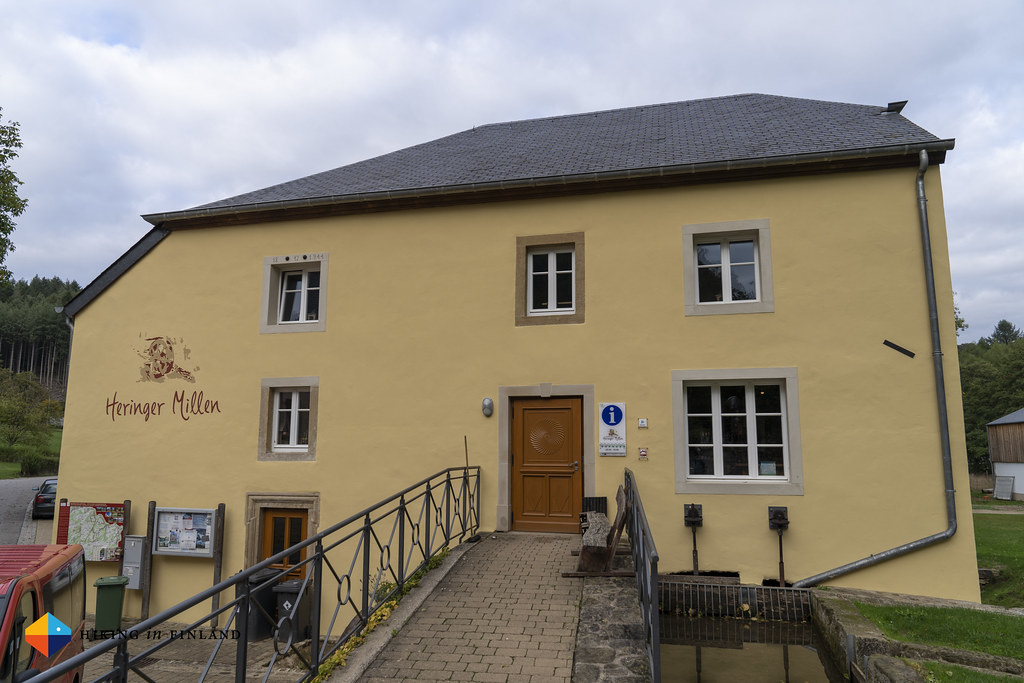
Almost at closing time we arrive at the Heringer Millen, the tourist centre in the centre of the Mullerthal Trail network. Here you can loan for free hiking gear, from shoes and jackets to backpacks and even binoculars and GPS receivers. We however take a look at the beautiful old mill, and then hit the trail one last time today to hike on the C5 Trail towards the Camping place “La Pinède”.


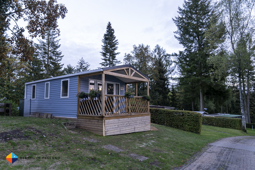
We stay tonight at a Mobilehome, which is nicer than it sounds. Our luggage awaits us as we arrive, and after a warm shower and putting all gadgets charging we head to eat at the Brasserie op Buergkapp, which is a Minute away from where we sleep. It’s a nicely decorated place with really tasty food, and after a delicious starter, main and dessert we fall happily into our beds!
Day 2 Consdorf/ Müllerthal - Scheidgen - Echternach
This was a long, sunny and enjoyable day of being outdoors in nature. After a good breakfast we hiked up to the Schiessentümpel, the largest waterfall in Luxembourg and most photographed spot on the Mullerthal trail. We were lucky that there wasn’t a lot of people around this early in the morning, so after many photos and a drone flight (watch the Video!) we continued.


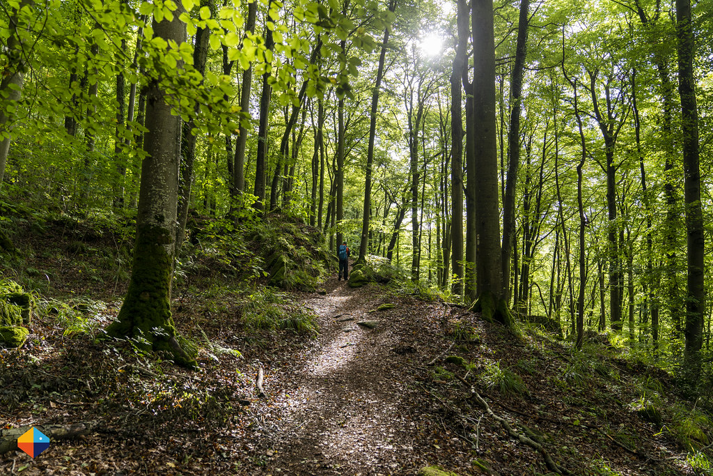
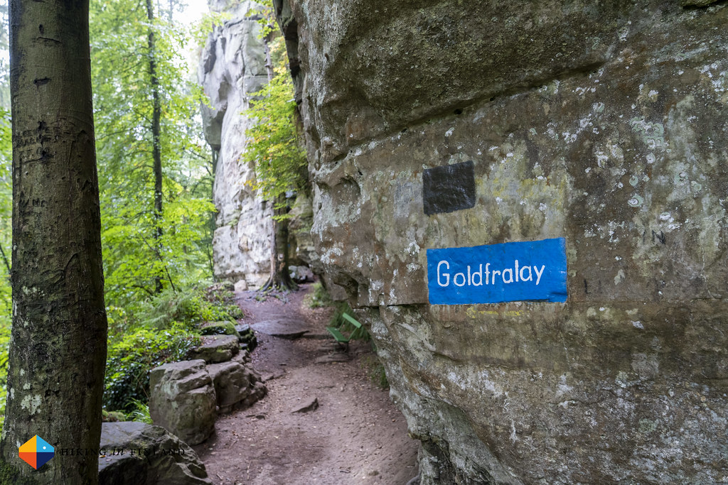
The trail leads up into the forest and we pass impressive rock formations like the Eulenburg, the Goldfralay with its little canyon and where a path leads up to the top of the cliff. It’s beautiful and we enjoy the scenery, hiking along these high rock walls.


We cross the street not far from the Consdorfer Millen, another mill, and are on a wide forest road while the sun climbs higher and sends its rays through the beech trees.


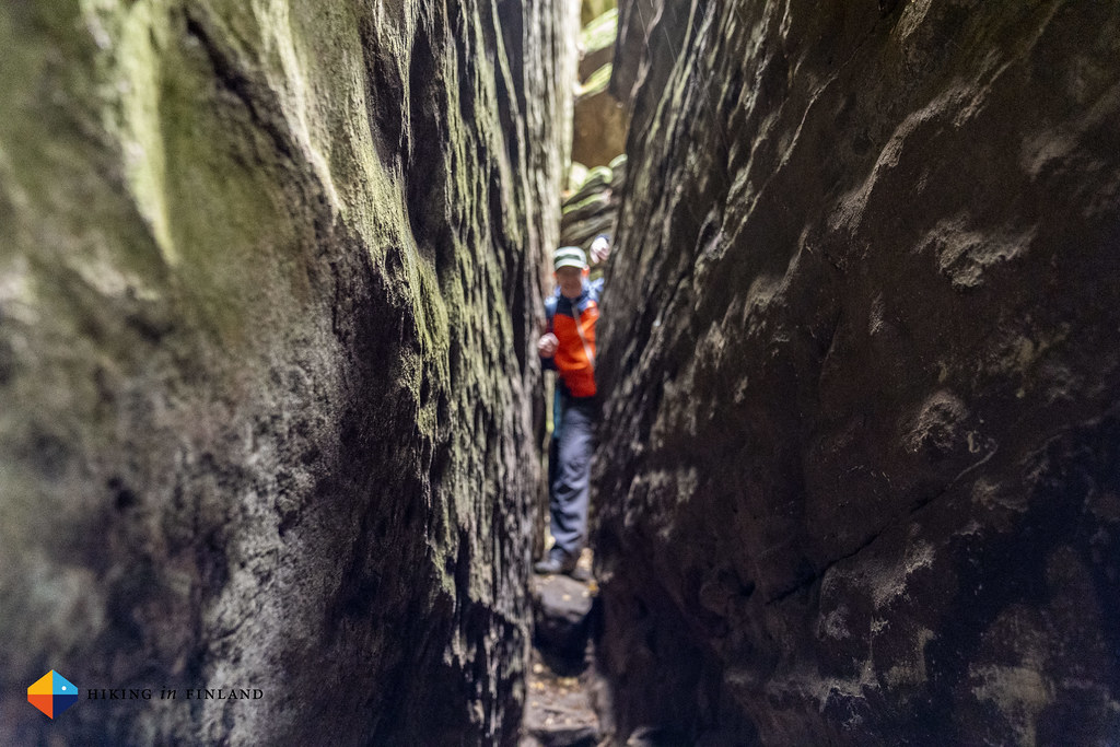
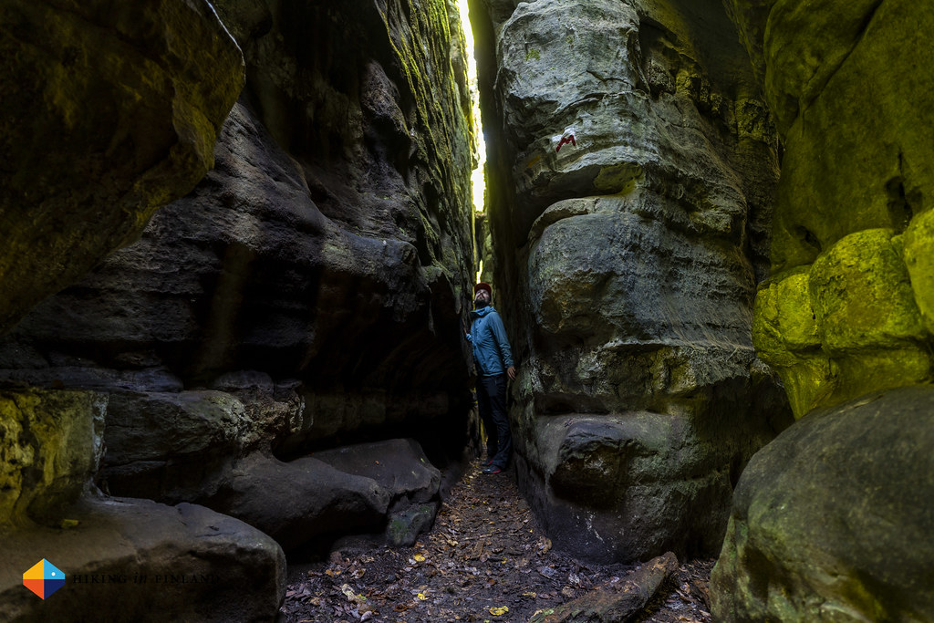
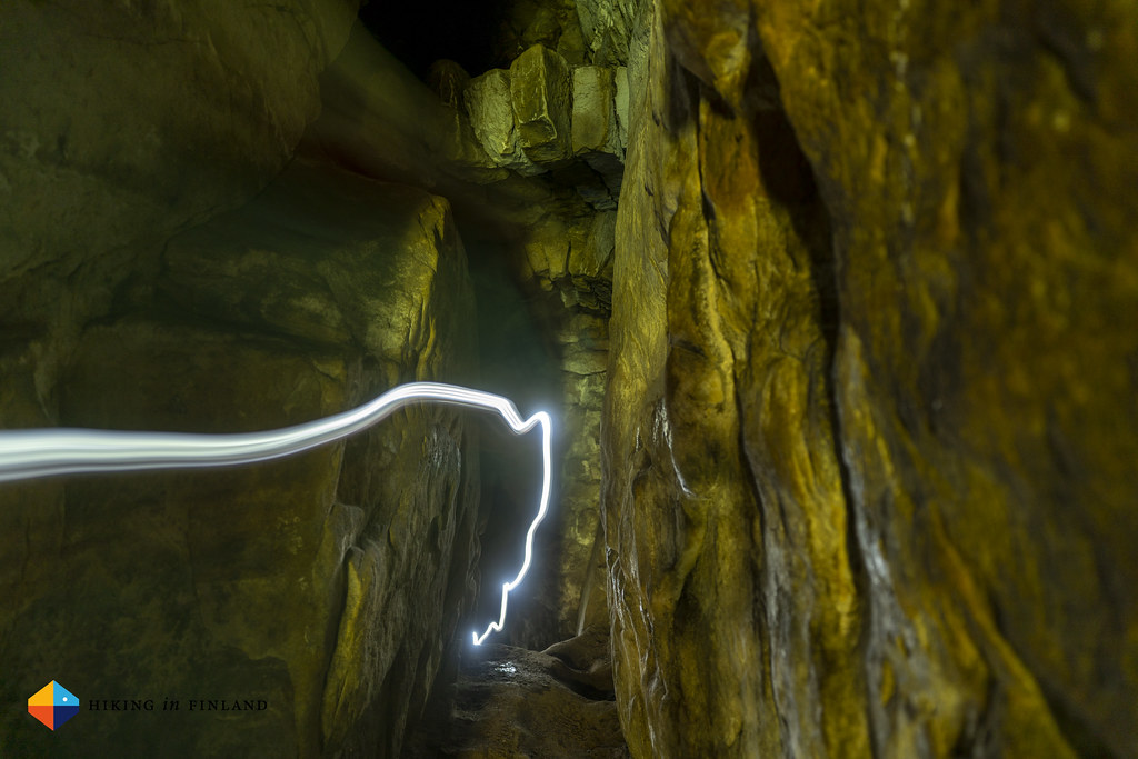
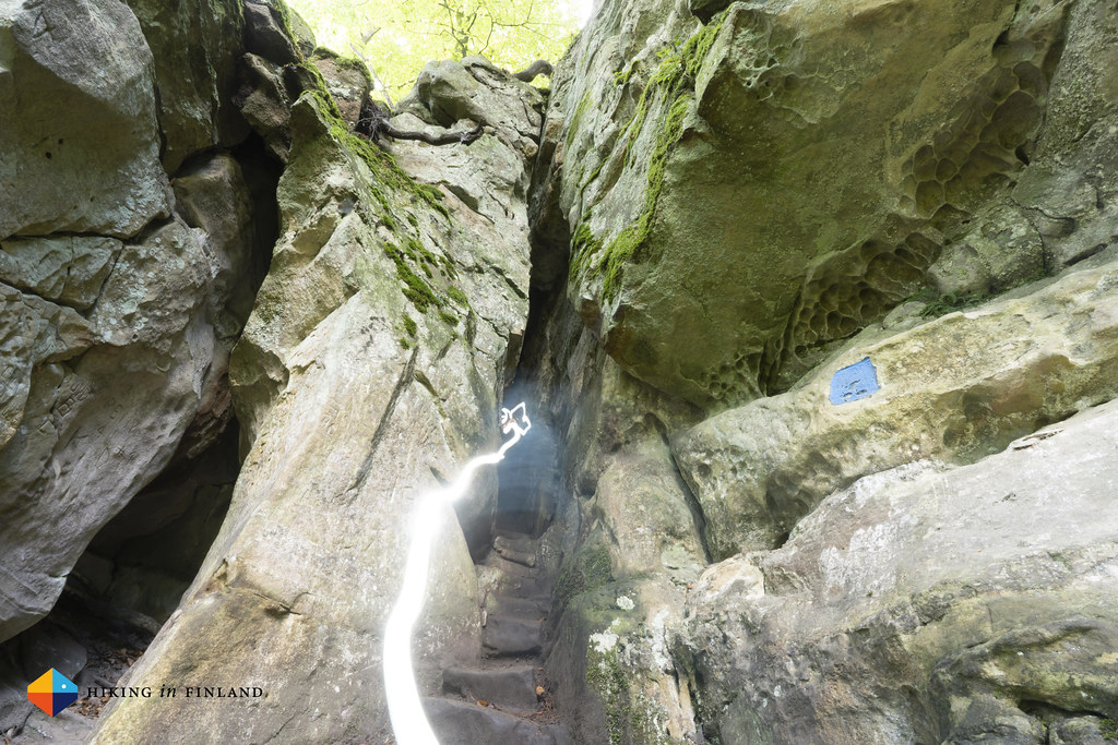
Then a narrow single trail path leads up into the forest, and not long and we are at the highlights of this section: Three very narrow canyons/ caves, two which also require a headlamp to get through as they are completely dark. First is the Rittergang, a narrow canyon through which Martin and I squeeze, laughing about this kind of experience.
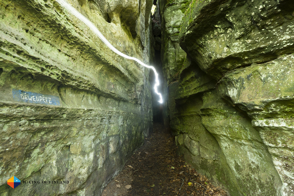
Next is the Deiwepetz canyon, which feels really long and the trail snakes through this even narrower canyon. It also gets pretty dark once you’re a few steps away from the entry, and I’m happy I have my Petzl IKO Core along.
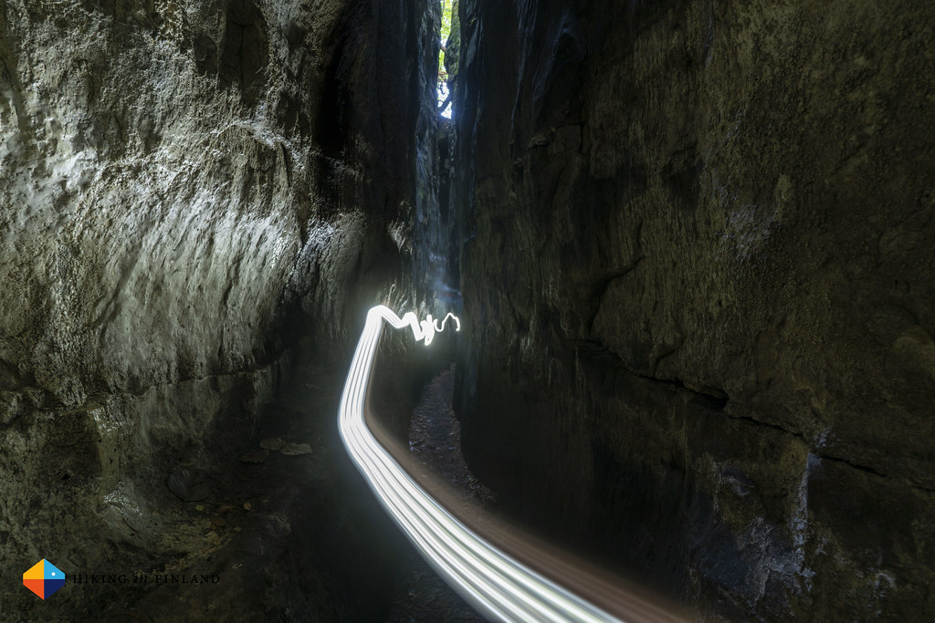
We exit the Diewepetz, smiling. The sun shines, it gets warm, and we have one more canyon/ cave in front of us, the best one if we can believe our guide book! To get to the Kuelscheier cave you can hike the marked Circuit Trail, which also takes you up to a viewing point, or you can stay on the trail and get to the entry of the cave. We chose to do the circuit, and then head into the cave. It takes a turn and you’re in immediate darkness, and without some light you’re quickly falling or hurting yourself, as it is narrow, there are corners, stairs and narrow passages.


We exit the cave and continue on Route 2 now towards Hersberg, though shortly before the village we take a shortcut and head onwards to Scheidgen.


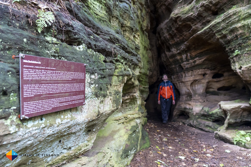
The warm weather and sunshine are very pleasant, we enjoy every moment out here in nature, being on this wonderful trail. And it does not get boring: It takes us along prehistoric grinding grooves and then leads up out of the forest and we cross some fields, before we are back in the forest. We cross small wooden bridges which allow us to keep the feet dry and take a look at the small Méchelskierch cave which was home to a hermit in the 18. century.


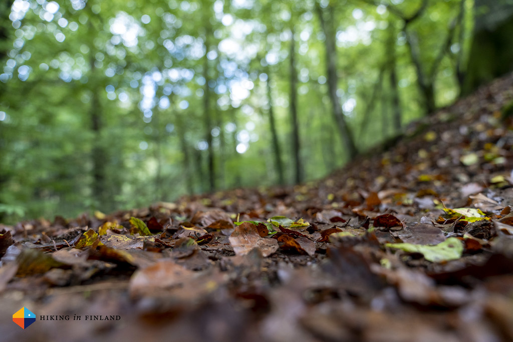
Brown leafs from past autumns are under our feet as we hike in the sun, onwards towards Scheidgen.


In Scheidgen we hope into the Hotel Bon Repos & Restaurant Le Grill for lunch. Martin has a very tasty looking Hamburger while I eat a delicious salad, and we enjoy the view into the kitchen were the Chefs are preparing our food. Route 2 continues now for another 8 km till Echternach, and we hike down into a narrow, wooded valley.

We are passed by three Trailrunners, and now encounter also some more hikers, but not really a lot.

Meanwhile the trail is showing itself from its most beautiful side. Light beech forests bath the trail in a warm, green-golden light, while the red-grey-green rock faces surprise us with different forms and make us smile.


After a few hours we arrive above Echternach and enjoy the view on the Abbey from up here in the forest. It’s funny how different it feels to come back here in warm weather and sunshine, and not soaking wet in the rain! We take a shortcut to the Campground, where we will be sleeping in a Wooden Barrel. We take a really nice warm shower and switch into some ∞ clean and ∞ fresh clothes, and head again to the Restaurant Aal Eechternoach for our celebratory Dinner!
Practicalities - Where to Stay, What to Eat and How to get Around
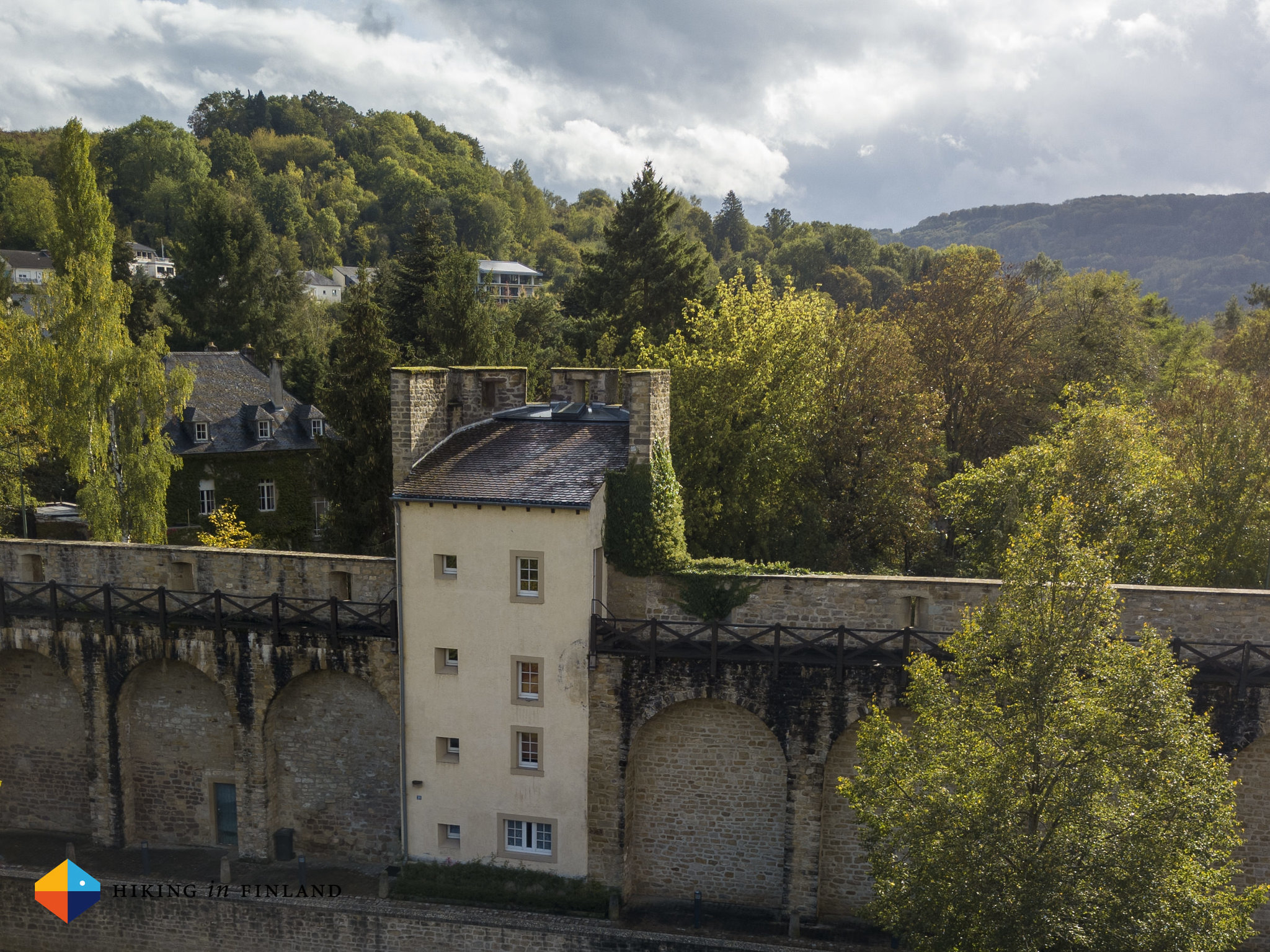
We stayed at the start and the end of our trip in Echternach, which is a small town - the oldest in Luxembourg - which we really liked. We stayed the first three nights in the medieval fortification tower Hämelmaous which really was a beautiful experience. There’s a cozy kitchen at the ground floor, and then there’s four more floors in this round tower. It easily should sleep a family of four or more, and it’s also really close to the centre and the bus stop. At the end of our trip we slept in a Wooden Barrel on the Campground, which was a really cozy experience as well. I slept like a stone in my barrel, which is good for one to two persons and possibly a small child or two. The camping place is a wee bit outta town - some five to ten minutes of walking to the centre, but really close to the trail.

While hiking Route 2 you can stay either at “La Pinède Camping” in Consdorf or at the Hôtel-Restaurant Le Cigalon in Mullerthal, both are along Route 2 and pretty much in the middle of this trail.
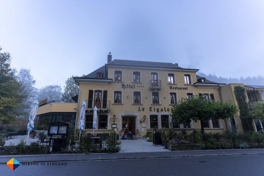
Both have options for eating out - at the Camping place in Consdorf we ate at the Brasserie op Buergkapp which was tasty and plenty, while at the 4⭐️ Le Cigalon the food was good but it took ages and portions are small - so if you’re hungry after a long day of hiking, pick wisely!

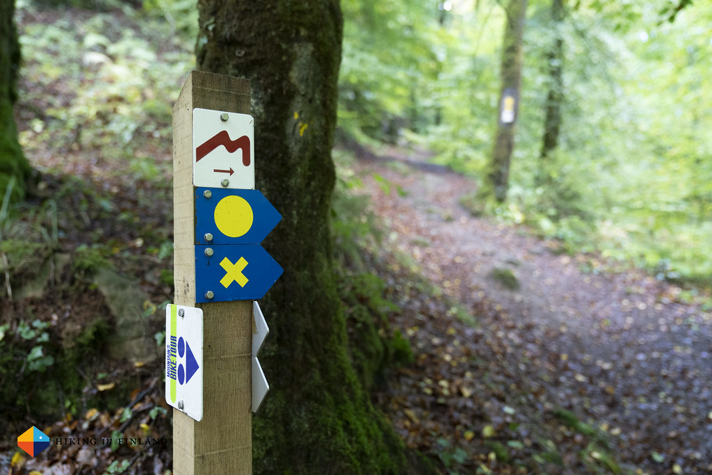
Public bus transportation in Luxembourg is free. Jump on a bus to get from one corner of the country to the other one (it’s a small country, so easy to do). The busses are plentiful and seem to stop even in the smallest villages, so hiking the Mullerthal Trail (or any other trail for that matter) in sections is easy to do.
If you enjoyed this article join the Patreon tribe (and get great discount codes from partners!) or buy me a coffee - I work Full-Time on Hiking in Finland to bring you inspiring trip reports, in-depth gear reviews and the latest news from the outdoors. You also could subscribe to the rarer-than-ever Newsletter and follow along on Instagram, Twitter, Facebook and Youtube for more outdoorsy updates!