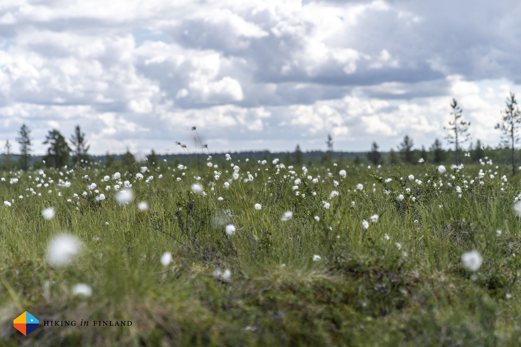
Well, practically I wasn’t alone in Lemmenjoki National Park, as there were about 17 Million Mosquitos, 3 Million Black (Horse) Flies, one Reindeer, one Hawk, one Eagle and dozens of tadpoles. But once I left the Gold Trail behind me, I was alone - and loved it!

Disclosure: I travelled on my own cost to Lapland and back. There are Affiliate links in this article which are marked with an ∞ Infinity Sign 😊 You can use these AT NO EXTRA COST TO YOU but I get a small provision from the company. As you know: I’m keepin’ it real and tell you how it is - I maintain full editorial control of the content published on Hiking in Finland. Read the Transparency Disclaimer for more information on blogger transparency and affiliate links.
You know what is the problem with Lapland? It’s so darn far away from Vaasa. To be precise, it’s a 4 hour train ride and an additional 12 hour car ride far away. That’s a lot of sitting on your buttocks, and Olli and me were mighty happy to roll on the very full parking lot of Lemmenjoki at 23:00 o’clock on a Sunday night in July. Now Lemmenjoki is Finland’s largest National Park, with an area of 2860 km², but also pretty inaccessible if you don’t have a car - as there’s not really any public transportation going to the Park - and it is also a bit “off-the-beaten-track” so we were pretty surprised to find a full parking lot. But then it was July, the month where Finns traditionally take holidays, and there’s also this Pandemic going on so maybe it was obvious that Finns will flock to their National Parks?

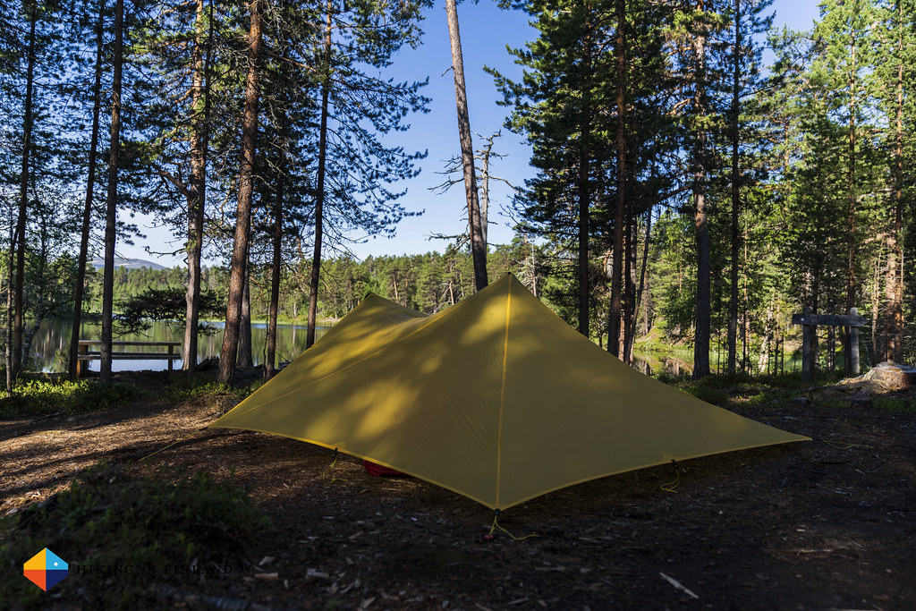
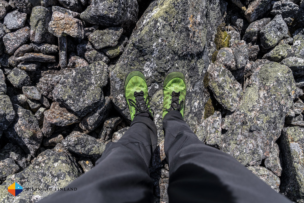
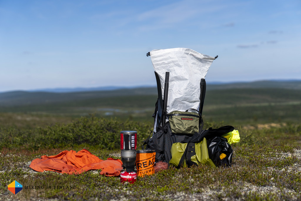
Anyway, after roughly 16 hours of sitting I put on my new ∞ inov-8 Mudclaw G 260 shoes, shouldered my heavy ∞ Southwest pack with food for nine days and all the packrafting gear, and then Olli and me hiked to the Muurhaislampi camp spot some 900 m away. The sun was still shining, there were a few Mosquitos accompanying us, and at the camp spot we also met some other hikers who were still up and pitching their shelters. Olli and me had an (non-alcoholic) beer to celebrate our arrival, and then it was off to sleep.
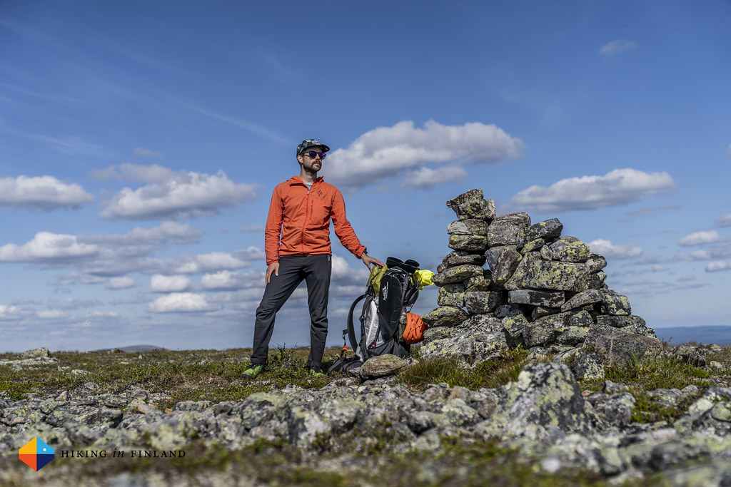
Well, I at least tried to sleep. A lonely Reindeer with a bell around its neck kept walking around the camp ground and the lake, the “ding-dong, ding-dong” of the bell keeping me well awake. I was up early thus, made my breakfast porridge and coffee and waited for Olli to appear. He’d accompany me for a few kilometres to the summit of Joenkielinen, before he would continue to Kevo Nature Reserve. A bit after 9:00 I started to hike, just to meet Olli an hour later at the Sotkajärvi Laavu, where he had breakfast and I another coffee (Olli isn’t one for a breakfast right after getting up!). The temperature was already warm - maybe around 21°C - by the time we started the climb up the fjell. I decided to leave my heavy pack down by the trail, and hid it a bit. Happily Finland is still a safe country where this is possible to do - I really enjoyed hiking up the mountain with nothing but my camera in hand and the HUCKEPACKS beiPACK around my shoulder.


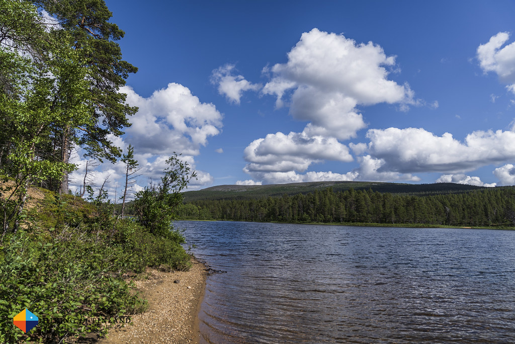
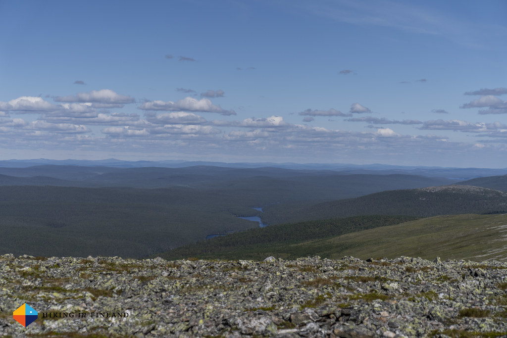
We summited 45 minutes later, a great speed for the 3 km and around 300 m of ascent, especially since it got warmer, and warmer. Up on the summit of Joenkielinen a stiff breeze was blowing which helped us cool down. Taking in the magnificent views we did: You could see till Norway in the North-West, the Muotkatunturi Wilderness Area in the North-East, and Hammastunturi in the East. Gentle, rolling hills in every direction, in between there were silver slices of water bodies on which the sun reflected, and of course forests 🌲🌲🌲🌲🌲. It was a great summit to view the surroundings, and a day later I’d be standing alone on an even higher summit. Olli and me said good-bye - we’d meet again at the weekend - and while he ran back to the Parking lot I hiked down to my backpack - which was still there!


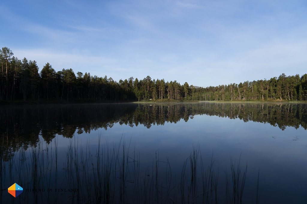
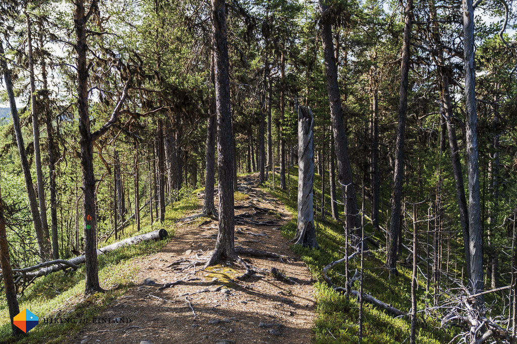
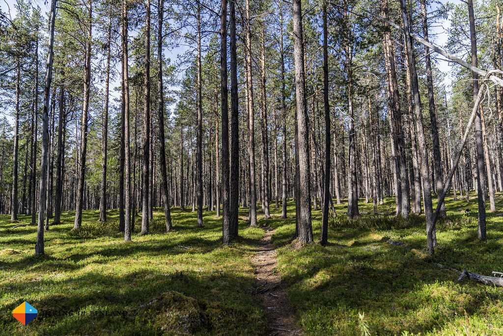
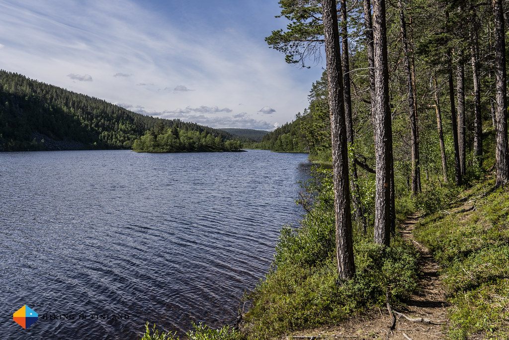
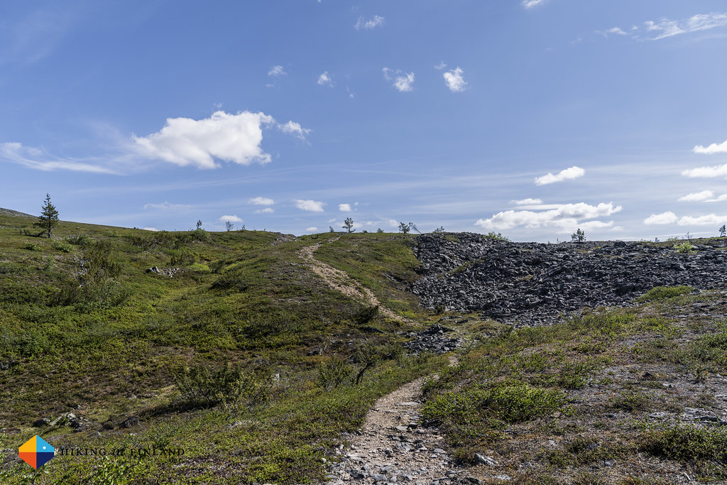
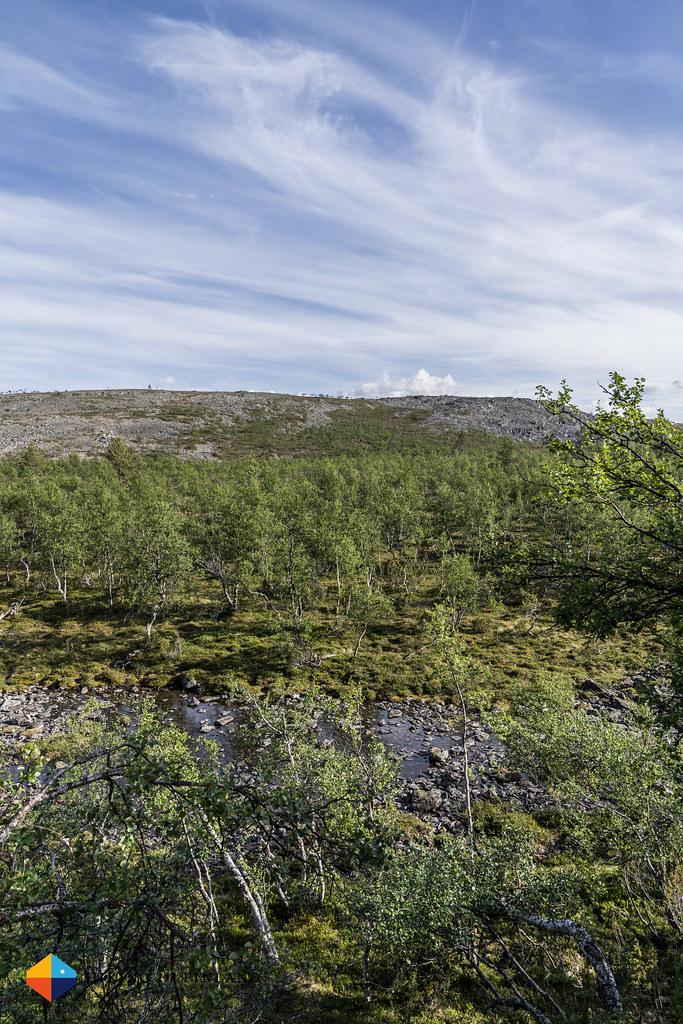
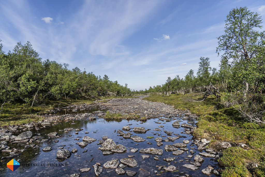
The trail continued as before, on a beautiful esker ridge which became a forest. I reached Searitniva after a while, and used the boat ferry to get to the other side of the Lemmenjoki river. There was a canoe and a row boat on the shore, and several people sitting around the ring of fire. I checked out the day trip hut, and then took my shoes off and ate some of my chilli nuts in the sun. I tried to slow down, not hurry to much, but didn’t enjoy the loud talking from the other people, so soon shouldered my ∞ SouthWest backpack again and continued. The 5 km to Härkäkoski were not fun: Too much mosquitos and horseflies where buzzing around me, and while they couldn’t get me because of the ∞ Sea to Summit Nano Mosquito Headnet I was wearing, their buzzing sound wasn’t pleasant, and neither was the by now really hot weather. I also didn’t have a coffee and the lack of caffeine did the rest.

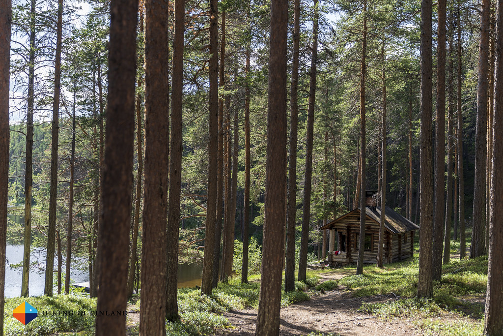
I arrived at Härkäkoski, where there’s a rental hut, a campground and another boat ferry. I filled up my BeFree water bottle, took the stove out and made myself a coffee, which made me feel a lot better. The next two kilometres to the Ravadasjärvi Hut felt amazing again, with a pretty trail, a lot less insects bothering me, and it also was less warm. I soon arrived at the Ravadasjärvi Hut, and it was 17 o’clock. A good time to stop hiking, but then I did want to go to Kultahamina.

I chilled in the sun, let my feet cool down in the water of the Lemmenjoki river, and then asked a dad with his two sons who were making dinner if they’d been to Kultahamina and if it is as pretty as here at Ravadasjärvi. “Nope” he said, this spot would be a lot nicer. I answered some of his questions, and then decided to call it a day and put my gear into one of the two open shelters and stay here. I did hike some 23 km after all, and this was a beautiful evening with the sun shining. I rolled out my quilt and mattress in the hut, and then went to sit outside to make dinner and a cup of tea. I got to chat with Maria, who was hiking on her own with her dog.

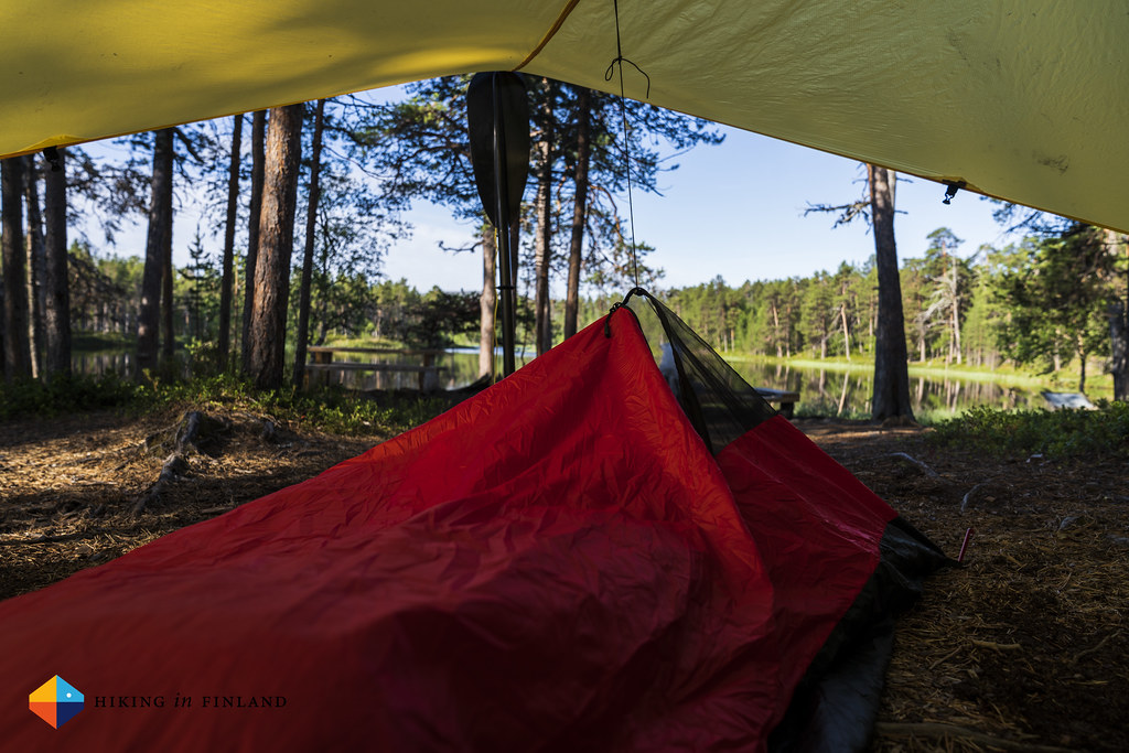
Later that evening Maria, her dog and me hiked to the Ravadaköngäs waterfalls, which were pretty in the evening light, and it also made for a good evening stroll. By 21 o’clock I was under my quilt in the bivy, the couple of mosquitos who found a way inside the hut trying to get to me, but without any success thanks to the mesh net. I slept a solid 10 hours till 7:00 the next morning, including a wee stroll in the middle of the night to photograph the sunrise which bathed Morgam-Viipus fjell in a beautiful light pink-orange glow.

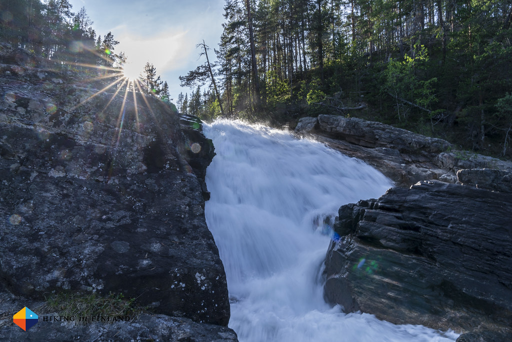


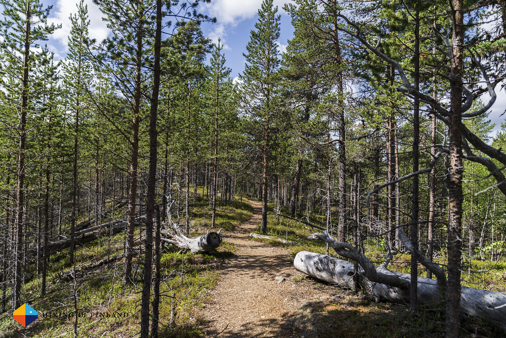
I was the first one up that morning, and silently enjoyed my breakfast. I had a long day ahead of me - because I didn’t camp at Kultahamina an additional 7 km were on top of my guesstimated 25 km route for the day, so you won’t be surprised to read that I was on the trail before 9:00 o’clock. I passed Ravadaköngäs again, this time the sun shining on the waterfall, and I enjoyed seeing it in this light again. The trail to Kultahamina was gorgeous, and I enjoyed this section immensely. Beautiful soft forest trails, passing some tiny streams which provided me with fresh, cold water on this already warm day, were very welcome. The Morgamnive campsite, down by the Lemmenjoki river, looked really inviting and even better than where I slept the previous night, but this are things you can not know before.
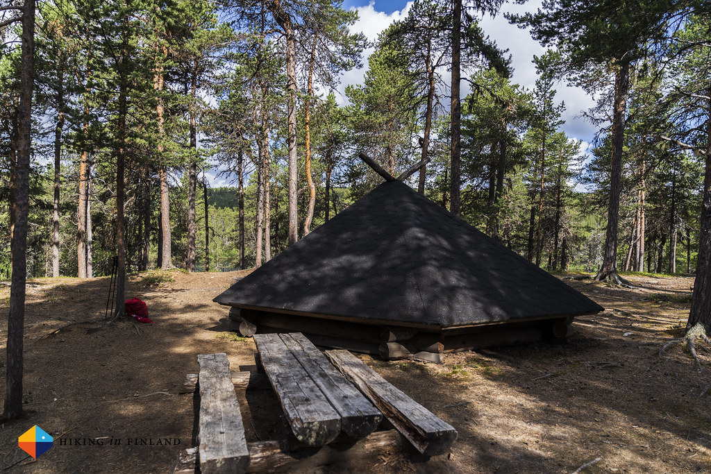
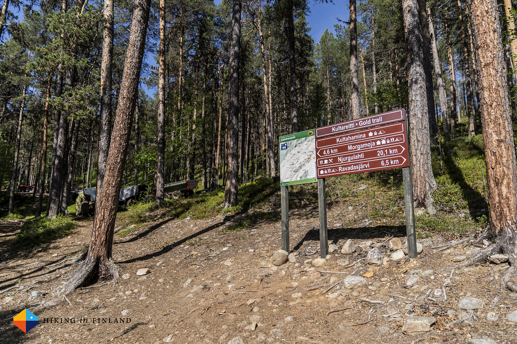
I arrived at Kultahamina around 11:00 and was put off by the 15+ Quads with trailers which stood under tarps close to the jetty and the open wilderness hut. Up till the 1st of July it was legal to search for gold in the National Park with “engine-powered machine” but now you’re only allowed to use a spade and a gold wash pan. I had a look around Kultahamina and had a small porridge break at the campfire place. A bunch of people started to hike past me, and I saw that one of the boats had arrived at the jetty. There’s a useful motor boat shuttle service running from Njurkulahti to Ravadasköngäs and Kultahamina twice a day, and many people use this possibility to either go up or down the river - it’s around 20 km of hiking you skip that way.
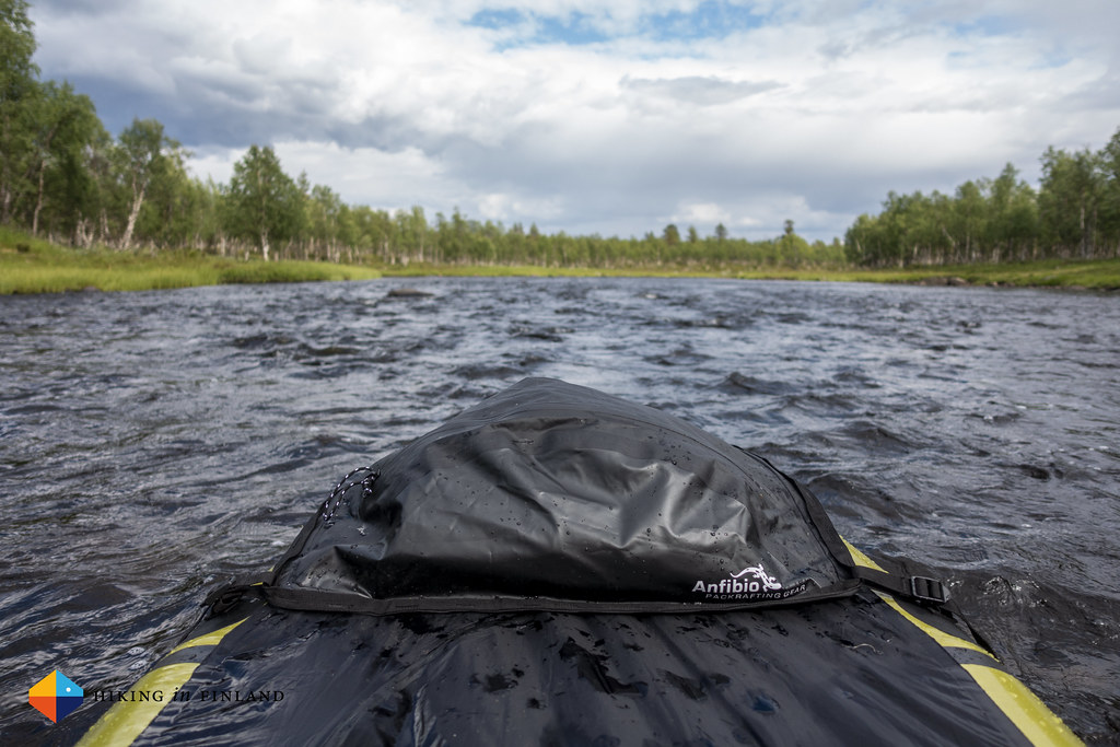
I finished my porridge and coffee and started the next leg of my hike. My map suggested there’d be an old trail crossing the river over to the other side, but shortly after exploring it the result was that my brand-new ∞ inov-8 Mudclaw G 260 were no longer bright green, but muddy brown - and I still wasn’t on the other side, but now also had wet shoes and socks. Yay! So back to the jetty I went, inflated my packraft and paddled in 3 minutes over to the other side.


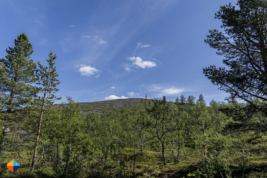
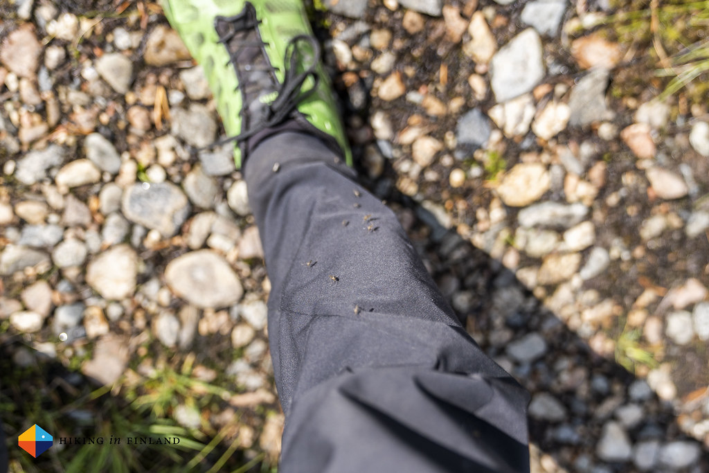
Once I had the packraft stored away again, the hardest stretch of the whole trip started: Hiking up to the summit of Morgam-Viipus. Roughly 400 m of ascent over 2 km, it was steep - add in a temperature of 22°C degree and my Army of Mosquitos and Black-flies which accompanied me, and you can picture how happy I was when I left the forest behind me and was above the treeline, where a nice breeze blew at least the annoying mosquitos away! During that strenuous hike I also was pondering the question if mosquitos and black flies have a territory which they inhabit and which they do not leave, or if they are nomads and would accompany me till Sallivaara or Ivalo 🤔
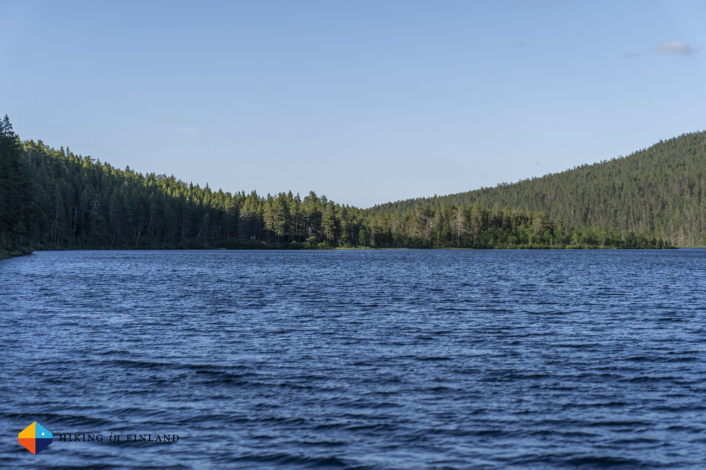
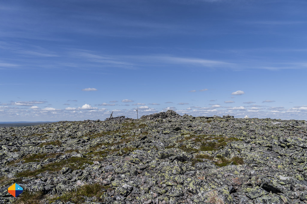
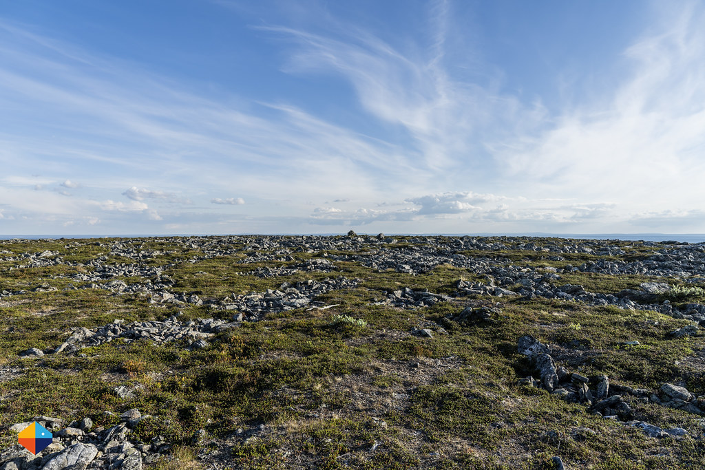
At the summit I had another coffee and chilled in the sun. It was a pretty day, and a large stone circle kept the wind at bay. The views towards the West were superb, as was my planned route towards the South and Sallivaara - it looked like a long day was still ahead of me… I walked on the soft, mossy ground to Viibosoaivi, and then passed a beautiful camping spot by the two lakes between the summit of Viibosoaivi and Sállejohoaivi. Tadpoles were swimming between the stones at the shore, there was little wind, plenty of flat spots for my TrailStar and bivy, and there were no mosquitos! I really should have just camped there - something which I can write now in hindsight, and which you should do when you’re going backpacking in Lemmenjoki!


I continued to the summit of Sállejohoaivi, and had dinner with a view. It was 17 o’clock, I was hungry, and I knew I wouldn’t be any time soon at Sallivaara, so I might as well make my pack a bit lighter and eat up here. I had a tasty REAL Turmat Vegan meal, a cup of tea and a smile on my face about the beauty which surrounded me. The sun ☀️ still stood high in the sky and it was warm, something which I welcomed as it meant I could hike in my T-Shirt here above the treeline.
My planned route now took me down via some boulder fields, and then I crossed a reindeer fence and a small stream before climbing a boulder field back up towards Jänisvaarat. When I arrived there, past 19 o’clock, I realized I had to abandon my original plan of hiking all the summits on my route towards Sallivaara. I had wanted to summit Iso Jänispää, Pikku Jänispää, Jänispäät and Jänispään Etelälaki on my route towards my goal for the day, but it was late, I was getting tired after already over 20 km of hiking and I wanted to arrive not too late. So I switched to the Altimeter view on my Suunto Spartan Ultra which helped me to stay on the same altitude - which meant I saved energy - while I skirted the Jänispää summits.

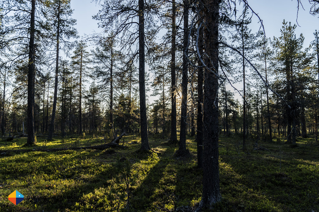
It was late - probably around 21:30 o’clock - when I stood on the summit of Jänispään Etelälaki. It felt the day went on forever by now, and I still had 5 km to go till Sallivaara. There were a few swamps which I had to cross, and as I now dropped down between the trees also my mosquitos friends were back around me, accompanying me on this final stretch. The hiking went through dense birch trees to swamps full of Labrador Tea to sparse pine forests, and of course shortly before reaching Sallivaara I had to cross a swamp and got wet feet. This seems to be Murphy’s Law for me - dry feet most of the day, but shortly before camp… they get wet. And muddy. Yay.


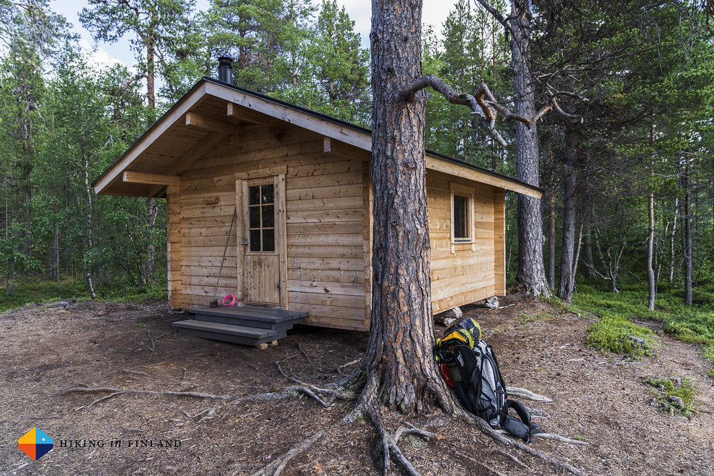
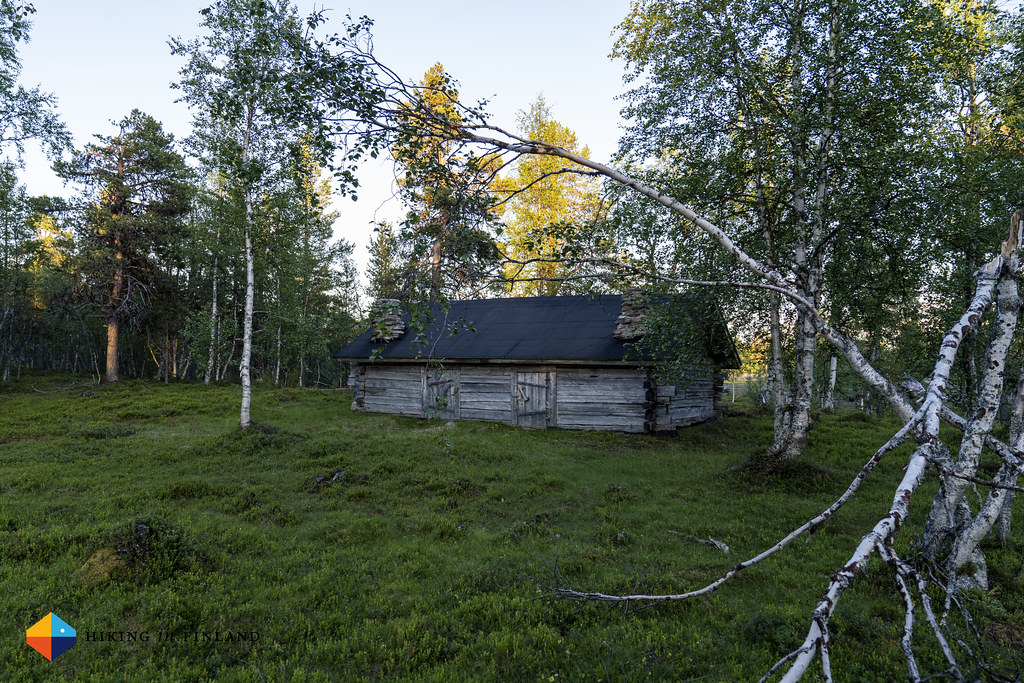
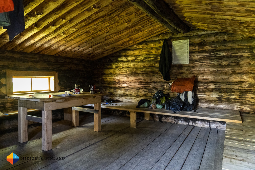
At eleven o’clock I walk inside of one of the huts at Sallivaara. There’s plenty of open huts here, but I need a moment to find the Open Wilderness Hut which is for us backpackers and hikers. I hang my sweaty clothes up, light a wee fire - more to get rid of the mosquitos and dry my clothes than to make it warm inside. The thermometer outside says it’s still 18°C, and I grab my two water bottles and walk to the spring. I have to cross the whole area to get to the small water spring, and am upset that I didn’t take my camera with me. It’s the Golden Hour, and the Reindeer Herding site, the huts and especially the absolutely gorgeous swamp are bathed in a golden light, and it all looks fantastic. Just the mosquitos… probably feel this walking buffet is for them. My hands are the only exposed skin, but it’s insane how many mosquitos land on them and get smacked to death in seconds. I must have killed three dozen mosquitos just while filling the water bottles at the spring, and then make a small run to leave most of them behind. Back at my hut I am just tired. It were 33 km, 26 km off-trail over the fjells, and so I slip into my bivy, happy that the mosquitos again can not get to me, and soon fall asleep.


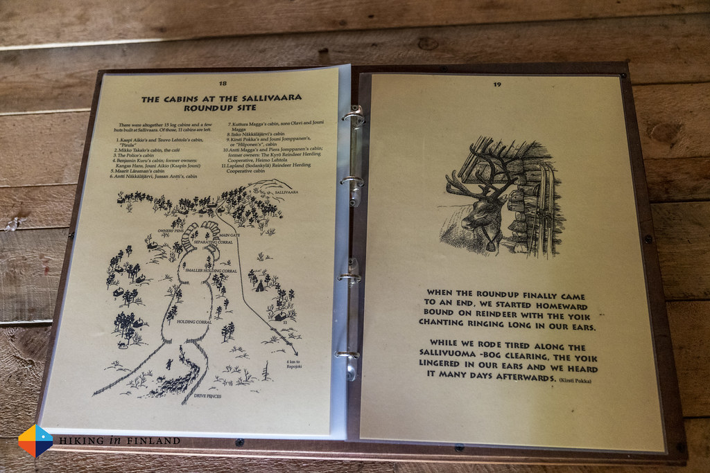
Wednesday morning I get up late - it’s 9:00 o’clock when I crawl out of my quilt. Minutes later the ∞ Windboiler is emitting steam, and I pour the boiling water in my large Kupilka Kuksa for my coffee. After the coffee I make a LYO Food coconut porridge, and start packing up. But before hiking to the Repovesi bridge and starting the packrafting trip of the part, I want to explore Sallivaara. My first stop is the information hut, which has information booklets in four or five languages about this site. The stories are beautiful, and tell so much of how infrastructure developments up here in Lapland can significantly impact the lives of the local Sámi people. Also the stories about the wolves, which have killed reindeer - but never a human - are things I wish more people would know.


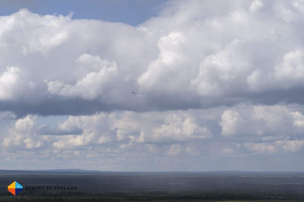
Next I hike up the hill. I felt like this wouldn’t be necessary as I was on much higher hills the previous day, and didn’t think that this wee summit has anything of interest to show. How wrong I was! I could see the magnificent swamp I saw the previous evening, many pretty forest islands in the swamp, lots of fine summits - and also the bridge I’d be hiking to! A bird of prey was calling, and some rain started to come down - just to stop a few minutes later. The views from the hill were great thus, and I was happy that I walked up. Back at the hut - it’s about one kilometre to the huts and the round-up fence - I shouldered my pack for the final 7 km of this trip.


These 7 km went through plenty of swamps, and all the mosquitos tried again and again and again to get a drop of blood from my hands. While the scenery was superb - I love hiking through swamps - the mosquitos and black flies, together with the warm weather, were really going on my nerves. It felt that if a breeze blew away a bunch of mosquitos while out in the open, 10 seconds later a new swarm was ready to annoy & attack me. I was so happy when I reached the road - where still dozens of mosquitos were around - and had my packraft inflated & packed, ready for the next leg of the trip.


Lemmenjoki National Park was amazing. I loved hiking on the Gold Trail, checking out the great huts and campsites along the way, and am a bit sad that I didn’t explore the North-Western part more, and also didn’t have time to go further south and check out some of the Fire Watch-out Towers. There’s quite a few open Wilderness Huts in the park, but besides the Gold Trail not really any trails - which makes it ideal for off-trail adventures. Hiking above the treeline is easy and rewarding with great views and no mosquitos, and down by the Lemmenjoki river you can see & learn about the gold rush history of the area.
The biggest down-side to Lemmenjoki is getting there. You can get with public transportation (for example via night train till Rovaniemi + bus) till Ivalo, but then you’ll need to invest around 90€ for the Taxi-ride to Njurkulahti - one-way. You always can try to split the costs for the Taxi ride with other hikers you might meet on the bus to Ivalo, or try to hitch a ride - here up North it can be really easy to get taken along. I was lucky that I was able to share a ride with Olli and that he dropped me off at the trailhead, but also that was a 12 hour ride from Jyväskylä (including some breaks!).
On the trail I encountered dozens of people, which surprised me as I didn’t expect so many people to come this far off-the-beaten track. But it seems there were many day hikers who used the motor boat shuttle up or down the river, so after the last pick-up around 19 or 20 o’clock in the evening only the backpackers are left, and they were few. I imagine in the off-season (beautiful autumn, starting soon!) you will encounter few people on the trail, and again no one off it. Make sure to have your navigation skills up-to-date, a map, compass and your favourite ∞ navigation app along for off-trail adventures, and then get ready to explore Finland’s largest National Park!

Want to see more? Watch my Video from backpacking in Lemmejoki National Park, and stay tuned as my trip will continue in the next article, in which I’ll tell you all about packrafting the Ivalojoki!
If you enjoyed this article Please support me on Patreon as this COVID-19 Pandemic means a severe loss of income for me (and you get Discount codes for kit from partners!) or buy me a coffee - I work Full-Time on Hiking in Finland to bring you inspiring trip reports, in-depth gear reviews and the latest news from the outdoors. You also could subscribe to the rarer-than-ever Newsletter and follow along on Instagram, Twitter, Facebook and Youtube for more outdoorsy updates!